.gif)
Direct Site of Intervention / 바로 선택한 사이트
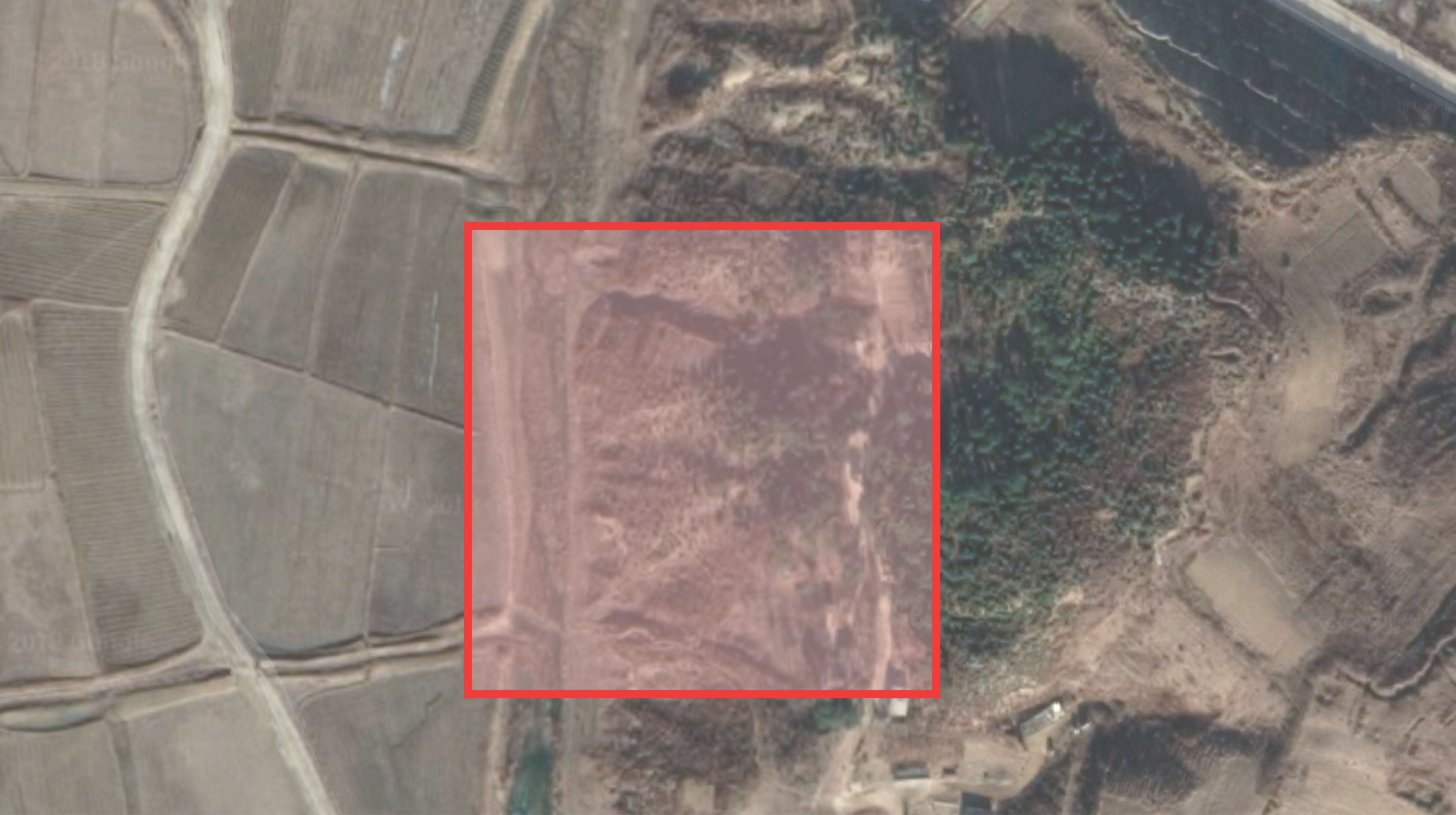
One of the harder problems that I had to address was deciding on the site of the start phase of the incubation for the educational facility. At first, I threw the site into Panmunjom, because I didn't have a clear idea of what factors were significant in what the site should have, and Panmunjom IS Peace Village, so I thought it was essentially a good "placeholder" until I did more research regarding the site of the thesis proposal.
내가 다루어야 할 더 어려운 문제 중 하나는 교육 시설에 대한 부화 시작 단계의 현장을 결정하는 것이 었습니다. 처음에는 판문점에 사이트를 던졌습니다. 사이트에서 어떤 요소가 중요한지에 대한 명확한 아이디어가 없었기 때문에 판문점은 평화 마을이므로 본질적으로 좋은 "자리 표시 자"라고 생각했습니다. 논문 제안 사이트에 관한 더 많은 연구를했다.

source
What's ironic is that the site ended up still being in the Panmun area, but with the scale of the building, I decided to designate a small area next to the mountains just on the southwest portion of the village, where there is a feeling of natural healing and the significance of the environment. Just like old times, the concept of feng-shui can be applied to the housing beside the educational facility.
아이러니하게도 사이트가 여전히 판문 지역에 있었지만 건물의 규모에 따라 자연의 느낌이있는 마을의 남서쪽 부분에 산 옆에 작은 지역을 지정하기로 결정했습니다. 치유와 환경의 중요성을 강조합니다. 옛날처럼, 배산임수개념은 교육 시설 옆의 주택에 적용될 수 있습니다.
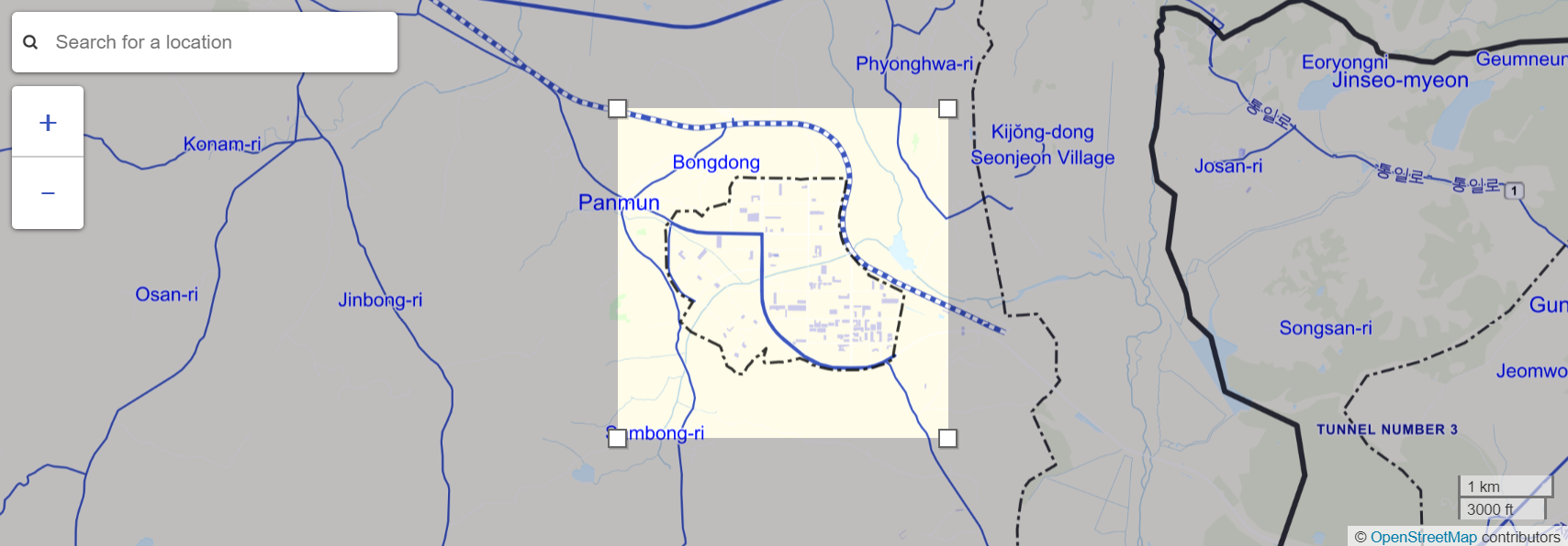
The Peace Village area. / 판문점 지역.
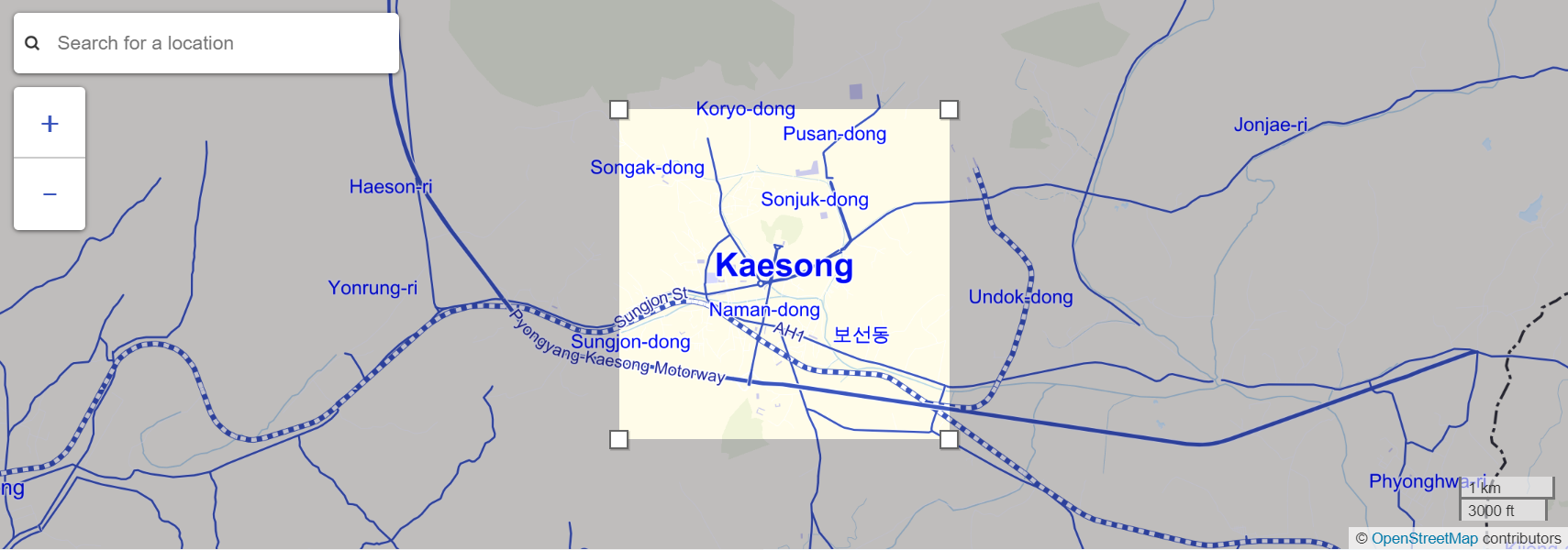
The Kaesong Industrial Complex area. / 개성 공단.
Cadmapper / "캐드 매퍼"
There is this great program called Cadmapper, where it allows you to designate an area of the world that can be turned into a CAD file with both the heights of buildings and the topography of the ground. This is a very useful program which can save me a lot of time regarding finding the accurate topography and building a site model that I can work on.
캐드 매퍼라고 불리는이 훌륭한 프로그램이 있습니다.이 프로그램을 사용하면 건물 높이와 건물 높이 모두에서 CAD 파일로 변환 할 수있는 세계 영역을 지정할 수 있습니다. 땅의 지형. 이것은 정확한 지형도를 찾고 내가 작업 할 수있는 사이트 모델을 구축하는 데 많은 시간을 절약 할 수있는 매우 유용한 프로그램입니다.
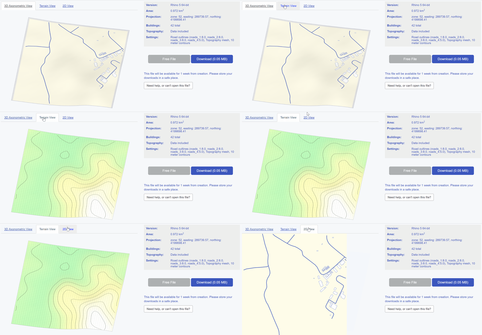
There is also another website that gave a more accurate depiction of the topographic lines of the site that I am working on. The problem with this whole process is that initially, I was going to rely on the GIS data that was readily available, but there are limited resources on what the surroundings or environment looks like in North Korea, and connecting the dots into an accurate representation of my site was very difficult.
또한 작업하고있는 사이트의 지형적 인 선을보다 정확하게 묘사 한 다른 웹 사이트가 있습니다. 이 모든 과정의 문제점은 처음에는 쉽게 이용할 수있는 GIS 데이터에 의존하려고했지만 북한의 환경이나 환경에 대한 정보가 부족하여 점을 정확한 표현으로 연결하는 데 한계가 있음을 알 수 있습니다. 내 사이트는 매우 어려웠습니다.
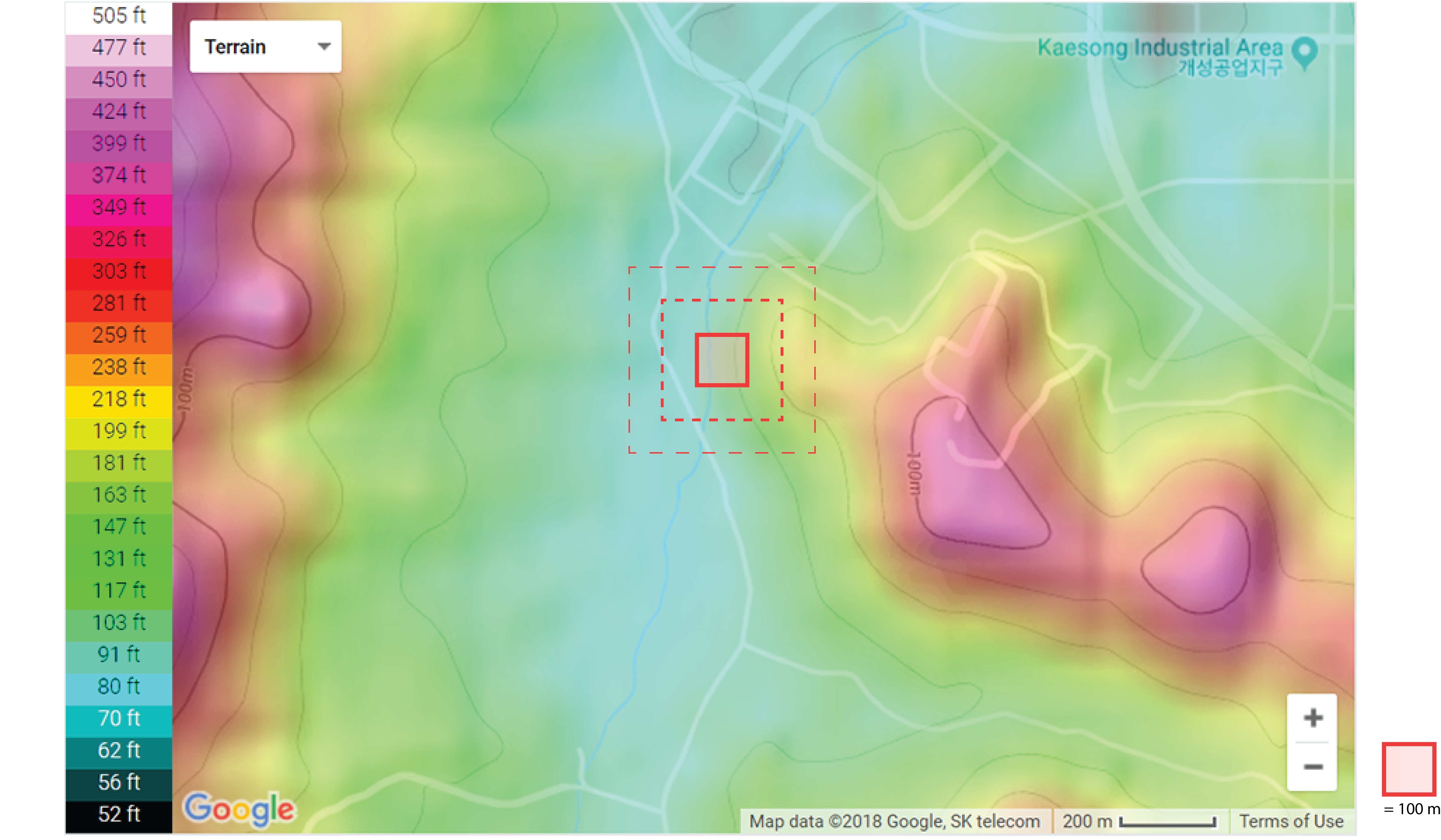
The Site and Why I Chose it / 사이트 및 내가 선택한 이유.
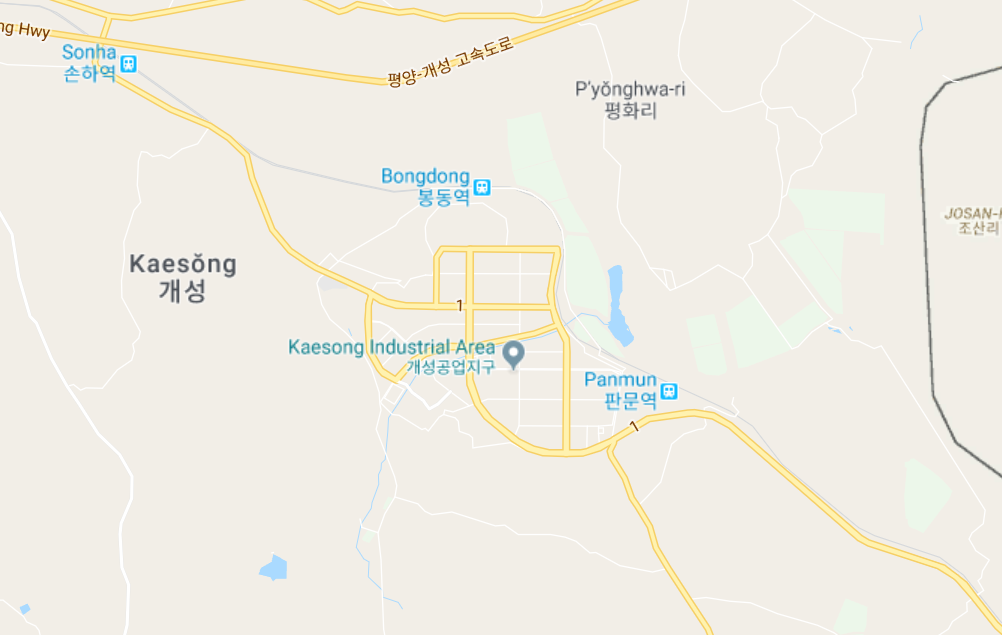
I've decided to choose this humble corner of the southwest Kaesong Industrial Complex area because it contains the core of the baesanimsu concept, which is the principle that the Hanok house typology that goes by the ideology that the ideal house is constructed with the mountain on the back, and the river being in the front. This is more commonly known as Feng Shui to most people. This dictates the placement of new villages, based on the existing mountain ranges and the flowing river systems.
나는 남한 개성 공단 지역의이 겸허 한 모퉁이를 선택하기로 결정했다. 그 이유는 배산임수 개념의 핵심을 포함하기 때문이다. 그것은 산이있는 이상적인 집이 건설 된 이념으로가는 한옥 집 유형론이라는 원칙이다. 등, 그리고 강이 앞쪽에있다. 이것은 일반적으로 대부분의 사람들에게 풍수로 알려져 있습니다. 이것은 기존의 산맥과 흐르는 하천 시스템을 기반으로 새로운 마을의 위치를 결정합니다.

source

As stated in my earlier article on Hanok houses, I believe that in order to fully utilize the proposed decentralization system of interwoven fabric of both existing and new plots of land, I believe that the environmental context of mountain ranges and river flow should be heavily considered as a significant factor in housing development. In addition, the Hanok housing type is still very prominent in the Kaesong region, therefore should serve as an important factor in vernacular architecture that represents what Korea was before they were split apart into the North and South.
한옥 집에 대한 이전 기사에서 언급했듯이 기존의 토지와 새로운 토지의 결합 된 분산화 시스템을 최대한 활용하기 위해서는 산맥과 하천의 환경 적 맥락이 크게 주택 개발의 중요한 요소로 간주됩니다. 또한 한옥 유형은 여전히 개성 지역에서 매우 두드러지기 때문에 남북으로 분열되기 이전의 한국을 대표하는 토착 건축의 중요한 요소가되어야한다.
