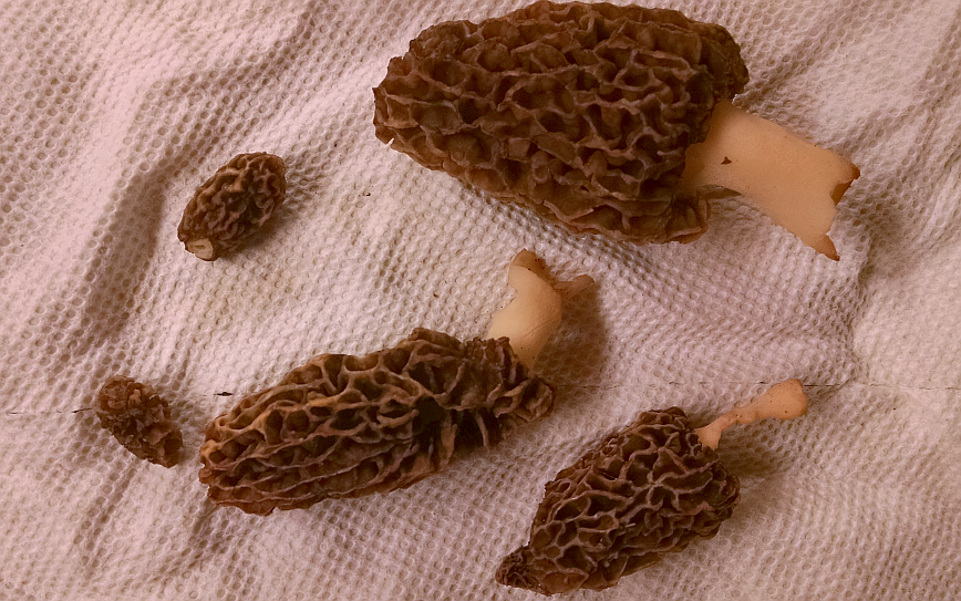
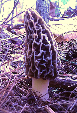
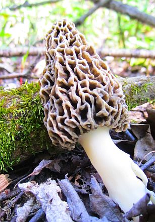
Each spring in the woodlands of the Northern Hemisphere a legendary mushroom comes out of hiding. The Morchella genus of fungi has as many as 30 species of morel that grow around the world. They are highly prized for their deliciously complex taste, but are difficult to cultivate artificially and can be tricky to find in nature. To make matters worse, many morel hunters fiercely protect their knowledge of where to find them (though others are more forthcoming). Information yearns to be free, and morel hunting deserves to be enjoyed by everyone!
Why are they so elusive?
Where / when do they grow?
Morels prefer well-drained soils with a moderate level of moisture. They will only appear when the temperature of the soil is approximately 52-58° Fahrenheit (11-15° Celsius), and neither too dry nor too moist. As a result, the start date and length of the growing season will vary by location and climate conditions.Trees favored by morels
Morels are most often found near the base of mature or recently deceased trees. There is some speculation that this may be due to changes in the soil chemistry after many seasons of composting leaf litter. A compiled list of favorable trees in the US include:- American Elm
- Tulip Poplar
- White Pine
- White Ash
- Bigtooth Aspen
- Cottonwood
- Cherry
- Maple
- Sycamore
- Red Elm
- Apple
How can I determine the best places to search?
One of the benefits of modern computing technology is the ability to process large amounts of spatial data using GIS (Geographic Information Systems). With the aid of open-source projects like QGIS, anyone with a computer can effortlessly sift through an incredible amount of extremely useful data for free. There is definitely a steep learning curve for some of the more complex functions of GIS, but learning how to display data is fairly straightforward.After installing GIS software, the next step is to locate the appropriate data for where you will be searching. There are hundreds of country, state, and local government resources that offer free spatial data. A well-phrased search including the term 'spatial data' and 'clearinghouse' will usually yield several results for your locality. If you live in the United States, this is a good place to look for federal-level data.
What data will help?
Any forestry data on tree stands from the state or federal government will assist with isolating places to search. Some states have more detailed data that includes attributes on the species, age, and density of the trees.
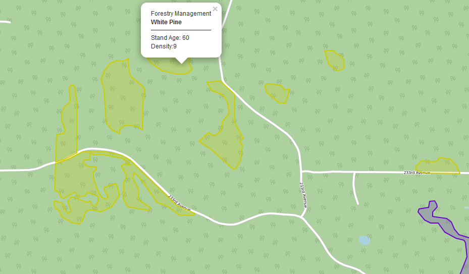 White Pine tree stands in a State Forest, basemap by OSM
Overlay the filtered tree data with the boundaries of federal land to help locate public places where morel hunting is legal. In the United States this generally includes State and National Forests but not State or National Parks. Regional parks each have their own regulations, so always research an area rather than assuming that morel hunting is allowed! Never hunt on private property without permission!
If you cannot find any detailed tree data for your area, you can still get ideas for where to search by looking at soil, hydrology, elevation, and land use data. The elevation data can be further processed to identify terrain features, while the land use data clearly identifies forested areas. Scanning through aerial photography is also an effective method for locating nearby forested areas.
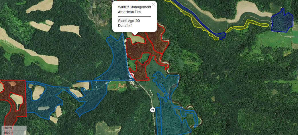 Filtered and color-coded tree stands with aerial basemap by ESRI. Warmer colors represent the most probable areas to find morels.
How do I find morels?
When to look
- After it rains. The optimum moisture level is achieved after a good soak as rain water infiltrates drier soil.
- In the morning. The low angles of sunlight in the dawn are ideal for spotting morels. It also helps to be the first person to look!
- Early spring. Monitor a soil temperature map to know when the temperature is right.
Where to look
- Soil moisture dictates how far from the base of a tree that morels can grow. During exceptionally dry seasons, they only grow in very close proximity to trees.
- Broad valleys near a stream are good places to look as they often have the right soil and moisture conditions
- Early in the season they tend to grow on south-facing slopes and ridge tops that get more direct sunlight. This warms the soil to a habitable temperature sooner.
- Late in the season they tend to grow in shaded areas and on north-facing slopes where the soil temperature remains cooler.
- Recently deceased Elm trees are famous for producing HUNDREDS of morels every year
- Morels tend to thrive in areas that have recently experienced fire.
How to look
- Walk slowly and scan the underbrush with your gaze slightly down.
- When you find an area with the right soil and trees, crouch near the ground and carefully look in all directions for several minutes.
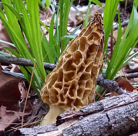
- Remember, morels do an excellent job of blending in with their environment. Train your eyes for pattern recognition before you hunt and bring a picture with you.
Once you find one:
- Look around - where there is one, there are often many!
- Sever the base of the stalk with a pinch or knife to avoid damaging the underground mycelium that produces morels.
- Mark the location on a map or with a GPS! Morels tend to return to the same spots each year.
- Carry picked morels in a mesh sack rather than a plastic bag to help spread their spores and allow them to 'breathe'.
- Soak the mushrooms in salt water for a few hours to kill harmful microbes.
- Coat the mushrooms in breadcrumbs or beer batter and fry in butter for maximum enjoyment.
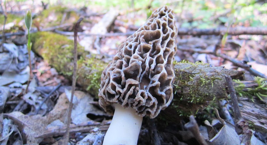
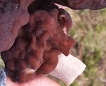
- Beware of poisonous mushrooms called 'false morels' that can be mistaken for real morels. Always make a positive identification and be sure that the cap and stalk of the mushroom are attached and hollow before eating any wild morels
Take it to the next level
With a little programming, you can turn your GIS data into an interactive app that works on your GPS enabled smartphone. This removes the guesswork and ensures that you always find the right spots! The open-source project Leaflet has a great community of friendly coders eager to help!Do you have any other tips or tricks for finding morels? If so, leave them in the comments! Thanks for reading my post!