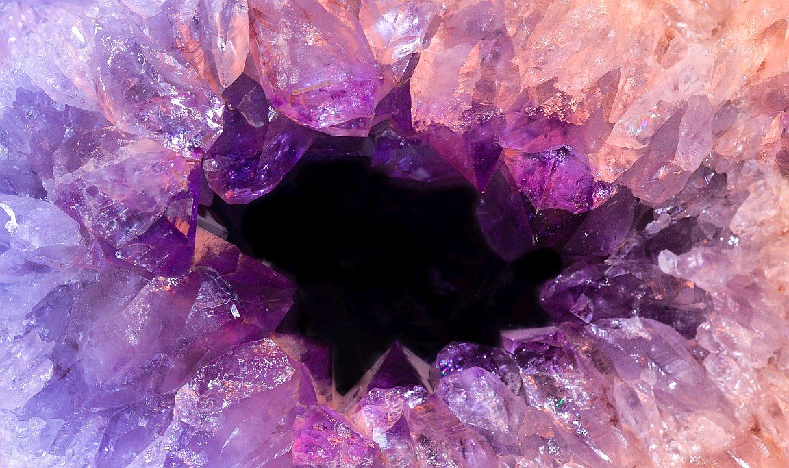
If you have read my recent article introducing geodes, you may be interested in trying to find some of these gems but are not sure where to start looking. Fortunately, spatial data and GIS can be used to assist with locating a great number of natural resources (including geodes). With a little effort, you too can use technology to narrow down the search locations and find the rocks you desire!
Keokuk Geodes
In order to find geodes, we first need to know roughly where to look. I live in the United States, so naturally I have decided to focus on some of the most famous geodes in the world, the Keokuk Geodes found near Keokuk, Iowa. The geodes are commonly found within a 50 mile radius of the town of Keokuk, which is on the tri-state border of Iowa, Illinois, and Missouri. The majority of geodes develop in a limestone rock unit known as the Warsaw Formation, although some can also form in the overlying Salem Limestone.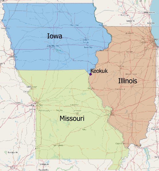
Figure showing the tri-state area surrounding Keokuk, Iowa. Base map provided by OSM
Gathering the Data
Based on the places where Keokuk geodes are known to form, geologic data should be gathered from three different states – Iowa, Illinois, and Missouri. While federal-level data is fairly centralized, each state has it's own state-level spatial data websites. Both bedrock and surficial geology layers are useful in this case, as we need to know where the geodes originate (limestone) and where they can be collected (alluvium). Federal-level data is often less current than state-level data, but it can be used whenever State data is unavailable.Iowa
Iowa has multiple resources for spatial data, but the geologic layers and a wealth of other information can be found at the Iowa DNR GIS website. The State also has a data website where additional spatial data can be visualized and downloaded. The Iowa Spatial Data Clearinghouse is currently being improved but will be another possible data source in the future.Illinois
Illinois state-level data can be downloaded from the clearinghouse. This is a good source for both of the desired geologic layers and a large number of other layers. Even more detail on the county-level can be downloaded from the State Geological Survey, though not all counties have complete data sets.Missouri
The relevant data for Missouri seems to all be compiled in their geoportal website. Here you can download statewide data and visualize the data extents. The Office of Geospatial Information is also another place to find useful links and resources.Federal Data
For some layers, federal-level data is desirable. For example, you might want to add the State boundary shapefile from the US data catalog. Additionally, the Forest Service has data on forest boundaries and the USDA has several data sets including the locations of public land in each state.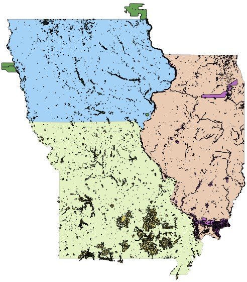
An overview of all public lands in Iowa, Missouri, and Illinois based on Federal data.
Importing the Data
Once you have downloaded and unzipped the desired data, the next step is to load the shapefiles into a GIS platform. In QGIS, this is accomplished by adding vector data to the map. After the data has been imported, you should see the extents of all three states.
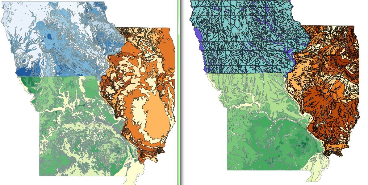
Figure showing the raw imported data for bedrock geology (left) and surficial geology (right). The layers are colored based on the unit name.
Projections
One problem that commonly arises when using data sourced from different organizations is that of projections. In a nutshell, projections are used to display spherical data on a flat map pane. There are thousands of different projections that are used across the world and it can be confusing to understand them. When working in QGIS, the projection of the first dataset that you import becomes the default projection for that project. You can find out what projection the data is in by referencing the metadata from the data source.If you need to convert data to a different projection, it is as easy as right-clicking on the data layer and clicking the 'Save As...' menu. This will bring up a dialog box where you can specify the desired projection in addition to other parameters. Although QGIS can display data from multiple projections 'on the fly' without needing to convert them, the data should be in the same projection to perform certain forms of analysis. For this project, the Missouri data must be converted to a NAD83 projection to match the other data.
Filtering the Data
The imported data sets are for entire states. While this is useful to have in some applications, for this project we are only interested in data that helps us to find Keokuk geodes.Surficial Deposits
The surficial deposit most likely to contain geodes is alluvium, the sediment commonly associated with creeks and rivers. The easiest way to filter out undesirable surficial deposits is to open the attributes table and select the rows that are associated with alluvium. This can be done manually for small data sets, or by formulating a selection query to highlight the desired entries automatically for larger data sets. After the appropriate rows are selected, use the 'Save As...' menu and make sure to check the box to 'Save only selected features'. The resultant files will only show the alluvium deposits.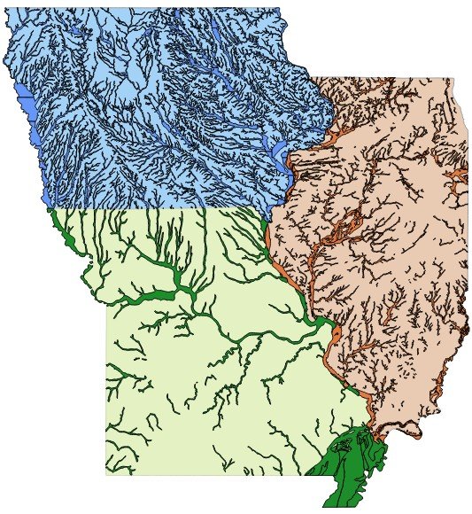
A look at all of the alluvium deposits across Missouri, Iowa, and Illinois.
Bedrock Geology
The surficial data can show where there is alluvium, but not where the geodes are in the alluvium. To get a better idea of where geodes can be found, we also need to filter the bedrock geology data so that it only includes productive units. The Warsaw and Salem formations are of Mississippian age, and are referred to as the Augusta Group in the Iowa data, a subset of the Meramecian Stage in the Missouri data, and by the formation names (Warsaw & Salem) in the Illinois data. After selecting and exporting the filtered geologic data, you should have a map that shows every location where the bedrock that contains Keokuk geodes can be found near the surface.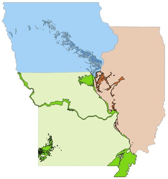
Locations where geode-producing geologic units are near the surface in the tri-state area.
Geologic Intersections
Now there are two sets of data; one telling us where the geodes exist in bedrock, and the other where alluvium exists. Neither data set explicitly indicates the best place to hunt geodes, but if we consider them together the probable locations become more precise. In QGIS there is an 'Intersection' process that can be loaded from the this menu path: Processing>Toolbox>Geoalgorithms>Vector>Overlay>Intersection. The tool compares two layers and outputs a file reflecting their intersections. Once this has been done for all three states, the combined outputs are locations where there is a high probability of finding Keokuk geodes.
Locations where geode-producing geologic units near the surface intersect with alluvium deposits.
Public Land Intersections
We can go one step further in refining possible locations by considering land ownership. Probable geode locations on private land will not prove very helpful, as trespassing is illegal and should be avoided. Fortunately, there are data sets from federal and state sources that define all of the parks, forests, preserves, and other public lands. Running an intersection analysis of these public lands against the geologic intersection layer produces a layer of probable geode locations on publicly accessible land. Please note that different land management units have specific regulations on the legality of collecting rocks and other artifacts, so make sure that rock hunting is permitted before taking any geodes!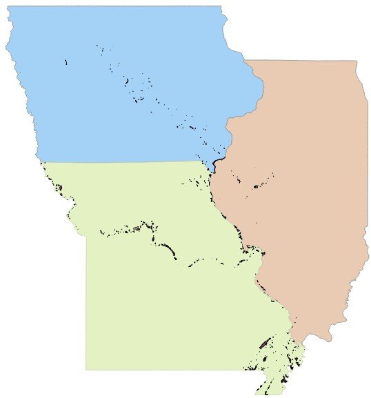
Locations where geode-producing geologic units near the surface intersect with alluvium deposits on public land.
Further Enhancements
There are even more methods for further refinement of these data sets. While alluvium deposits on public land in the right bedrock units are helpful, geodes are only easily found if the alluvium is exposed and not buried underneath a layer of soil. Hydrologic datasets available on both the state and federal scale can be used to identify watersheds and drainage valleys. Furthermore, a remote sensing analysis of the terrain through aerial photos or topographic maps will help isolate the best alluvium deposits and drainages. In QGIS you do not need to download individual base maps if you install the OpenLayers Plugin. This plugin appears in the Web menu and allows you to load several different base maps as needed in real time rather than downloading the tiles in advance.Known Locations
There is already at least one existing map of known locations where Keokuk geodes can be found. The places indicated on this map overlap quite well with many of our 'probable locations', and our layer even includes additional spots beyond the immediate tri-state area that should also be productive. It should be noted that geodes can be found in alluvium deposits far downstream from the source bedrock, so by only considering where the bedrock and alluvium intersect we will likely overlook some quality geode hunting locations. It should not be assumed that any of the identified locations will have geodes; there are many factors such as the weather and human removal that influence where geodes are found. This analysis merely highlights some possible locations!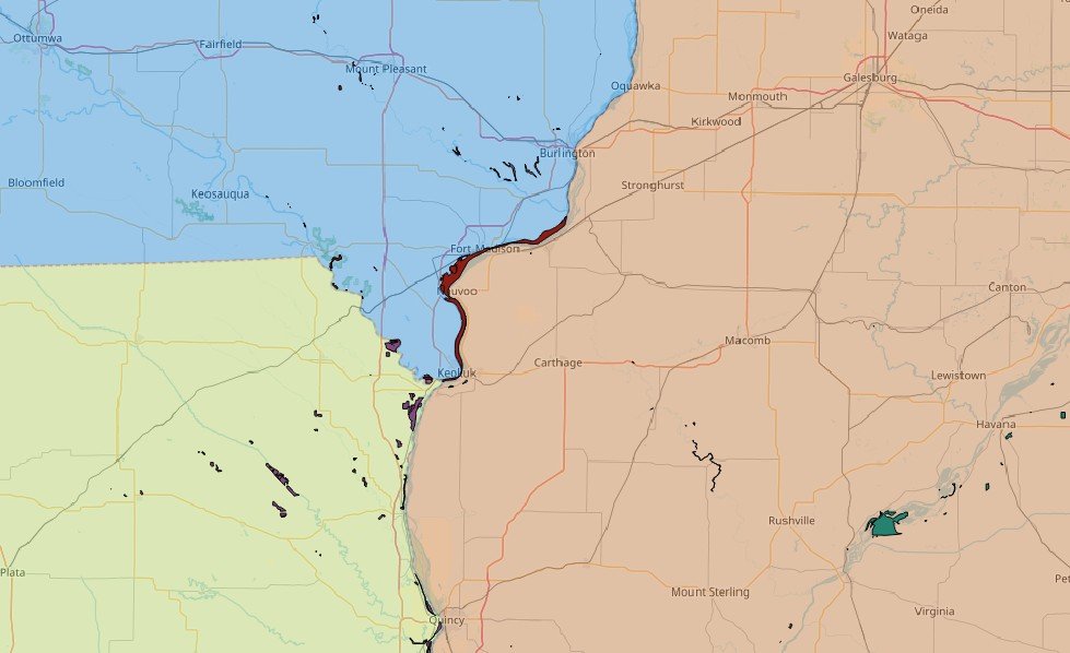
A closer view of the probable geode locations on public land near Keokuk for comparison to the known locations map. Base map provided by OSM