Dear Steemians
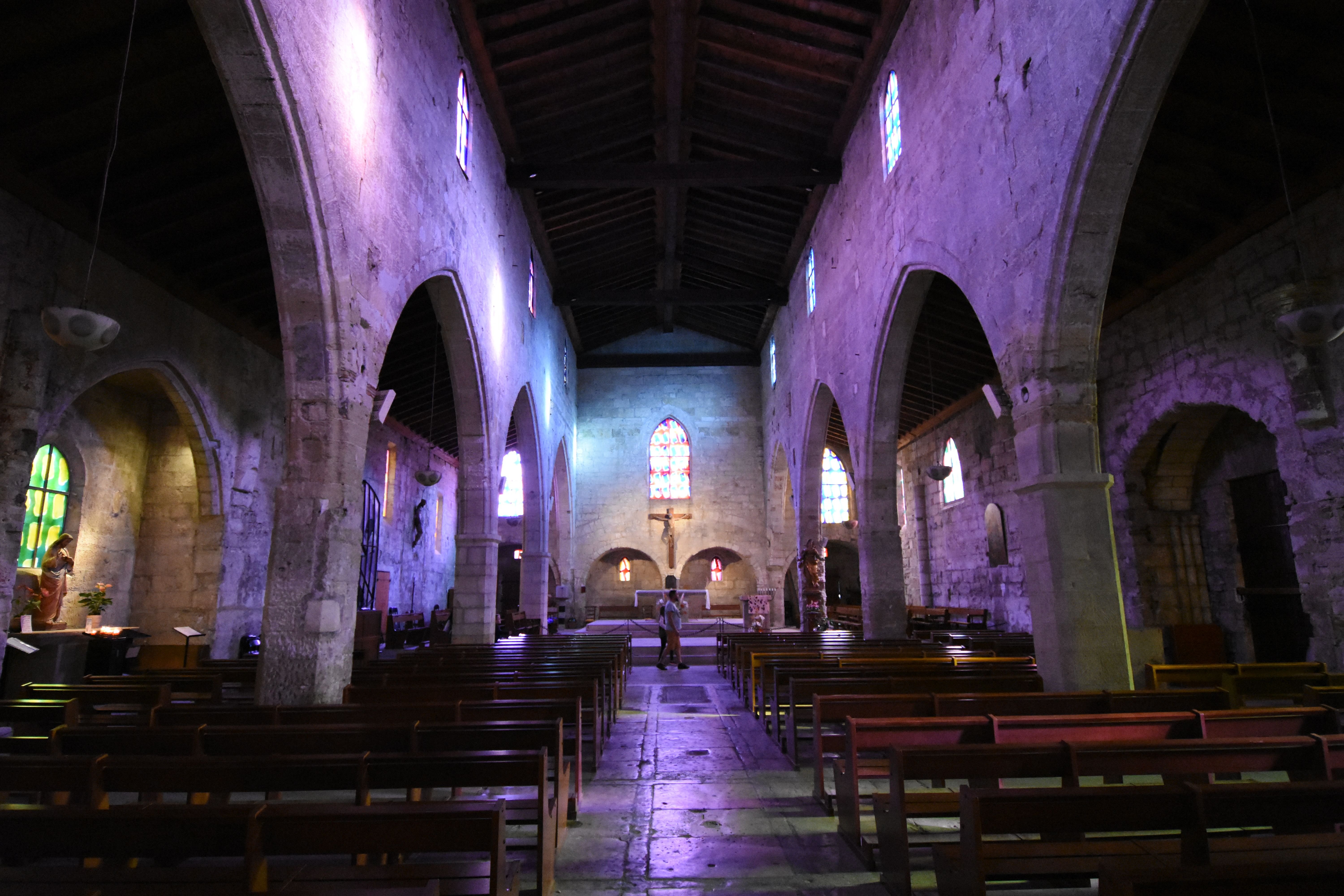
Yesterday I presented the church Notre-Dame des Salons in Aigues-Mortes, Gard, South of France. Today I want to introduce you to the part of the city in the old city walls.
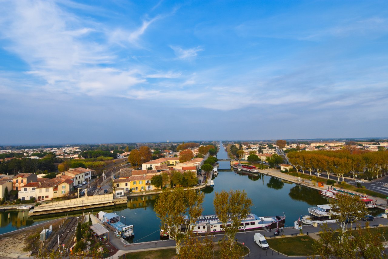
Aigues-Mortes, in English: Dead Water, was conceived in the Middle Ages as a port city, but today, after the sedimentation of the shallow water zone, is located about six kilometres from the Mediterranean Sea. However, the city can still be reached from there via a channel. Aigues-Mortes is also located on the Canal du Rhône à Sète, which is a navigable link between the Rhône river and the town of Sète.
The walls of Aigues-Mortes were built by Saint Louis. Indeed, Louis IX wanted to create a market in the Mediterranean from the beginning of his reign. In this context, he built the port of Aigues-Mortes.
Gaius Marius mentioned the settlement around 102 BC. The name Ayga Mortas ("Dead Water") was first used in the 10th century. Until the 16th century, Aigues-Mortes was one of the most important transport hubs on the French Mediterranean coast. From here Ludwig the Saint, whose statue was erected on the main square, sailed for the Sixth and Seventh Crusade. Charles V and Francis I met in Aigues-Mortes in 1538 to conduct the negotiations leading to the Treaty of Nice.
Liebe Steemians
Gestern hatte ich unter dem Tag "architecutralphotography" die Kirche Notre-Dame des Salons in Aigues-Mortes, Gard, Südfrankreich vorgestellt. Ich will Euch heute den Rest der Stadt, sofern er sich in den alten Stadtmauern befindet vorstellen.
Aigues-Mortes, zu Deutsch: Totes Wasser, wurde im Mittelalter als Hafenstadt konzipiert, liegt aber heute, nach der Verlandung der Flachwasserzone, rund sechs Kilometer vom Mittelmeer entfernt. Die Stadt ist aber von dort aus noch über einen Kanal erreichbar. Aigues-Mortes liegt außerdem am Canal du Rhône à Sète, welcher eine schiffbare Verbindung zwischen dem Fluss Rhône und der Stadt Sète darstellt. Die Stadtmauern von Aigues-Mortes wurden von Saint Louis erbaut. Tatsächlich wollte Louis IX von Beginn seiner Herrschaft an einen Absatzmarkt am Mittelmeer schaffen. In diesem Zusammenhang errichtete er den Hafen von Aigues-Mortes. Gaius Marius erwähnte die Siedlung um 102 v. Chr. Der Name Ayga Mortas („Totes Wasser“) wird im 10. Jahrhundert erstmals verwendet. Bis zum 16. Jahrhundert war Aigues-Mortes einer der wichtigsten Verkehrsknotenpunkte der französischen Mittelmeerküste. Ab hier segelte Ludwig der Heilige, dessen Statue auf dem Hauptplatz errichtet ist, zum Sechsten und Siebten Kreuzzug ab. Karl V. und Franz I. trafen sich 1538 in Aigues-Mortes, um die Verhandlungen zu führen, welche zum Friedensvertrag von Nizza führten. The view from Constance-Tower: Tower of Constance: Look what you used to have to pour pitch and sulphur over your enemies. Seht nur was man früher hatte um Pech und Schwefel über ihre Feinde zu giessen Known from my yesterdays post: Notre-Dame des Sablons: The outside of Notre-Dame des Sablons. A modern bike in an ancient city: I hope you liked my post and I wish you all a wonderful day. Take care, Yours, Patrick Ich hoffe, dass Euch mein Beitrag gefallen hat und wünsche Euch allen einen wunderschönen Tag. Pass auf Euch auf, Euer Patrick !steemitworldmap 43.566711 lat 4.190106 long Aigues-Mortes, France D3SCR
Die Aussicht vom Constance-Turm

Constance-Turm:


Bekannt aus meinem gestrigen Post: Notre-Dame des Salons:
Die Aussenseite von Notre-Dame des Sablons


Ein modernes Rad in einer antiken Stadt:

Du willst mehr von mir sehen? Click: