San Francisco was my home for three months. And I went downtown every day or studied at my temporary home, minutes away from the Golden Gate Bridge. The end of my adventure was nearing and I told myself that it would be embarrassing to return home without seeing California. My rental car was collecting dust in front of the house and I had the weekend off. I noticed that there was this city called Eureka north of San Francisco and since I am pretty geeky (and loved the Eureka tv show) I just had to go see it.
I booked a hotel in Garberville, some 320 kilometres north of San Francisco and drove there Friday evening. The town wasn't impressive at all, but they do know how to prepare a good steak there! It was a good base for my weekend. The next morning it was time to explore.
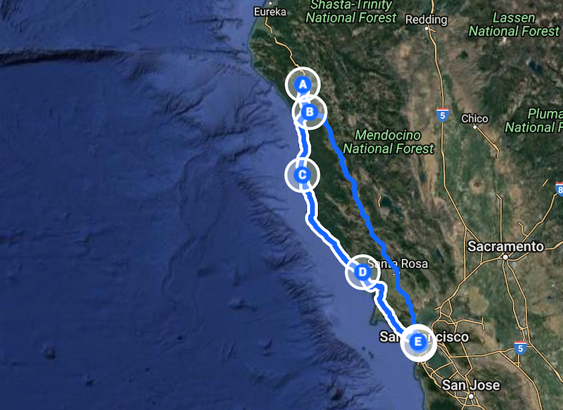
Saturday
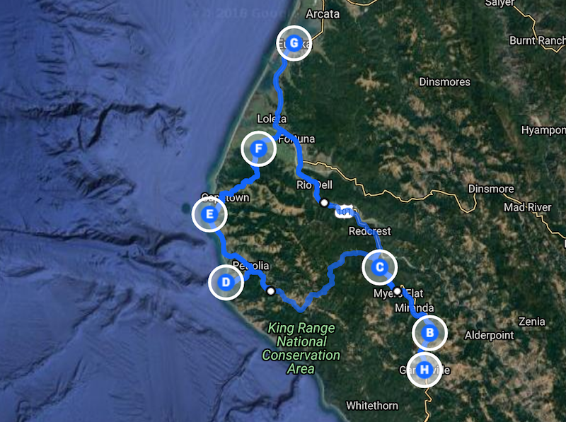
Saturday route
The starting point is where the H is (blocking the A). Of course, I didn't prepare that well... all I knew was that I wanted to go see Mattole Beach (D) and some friends told me to make sure that I would see Ferndale (F). The plan was to take the 101 North and take a left turn near Weott (C) into the forest.
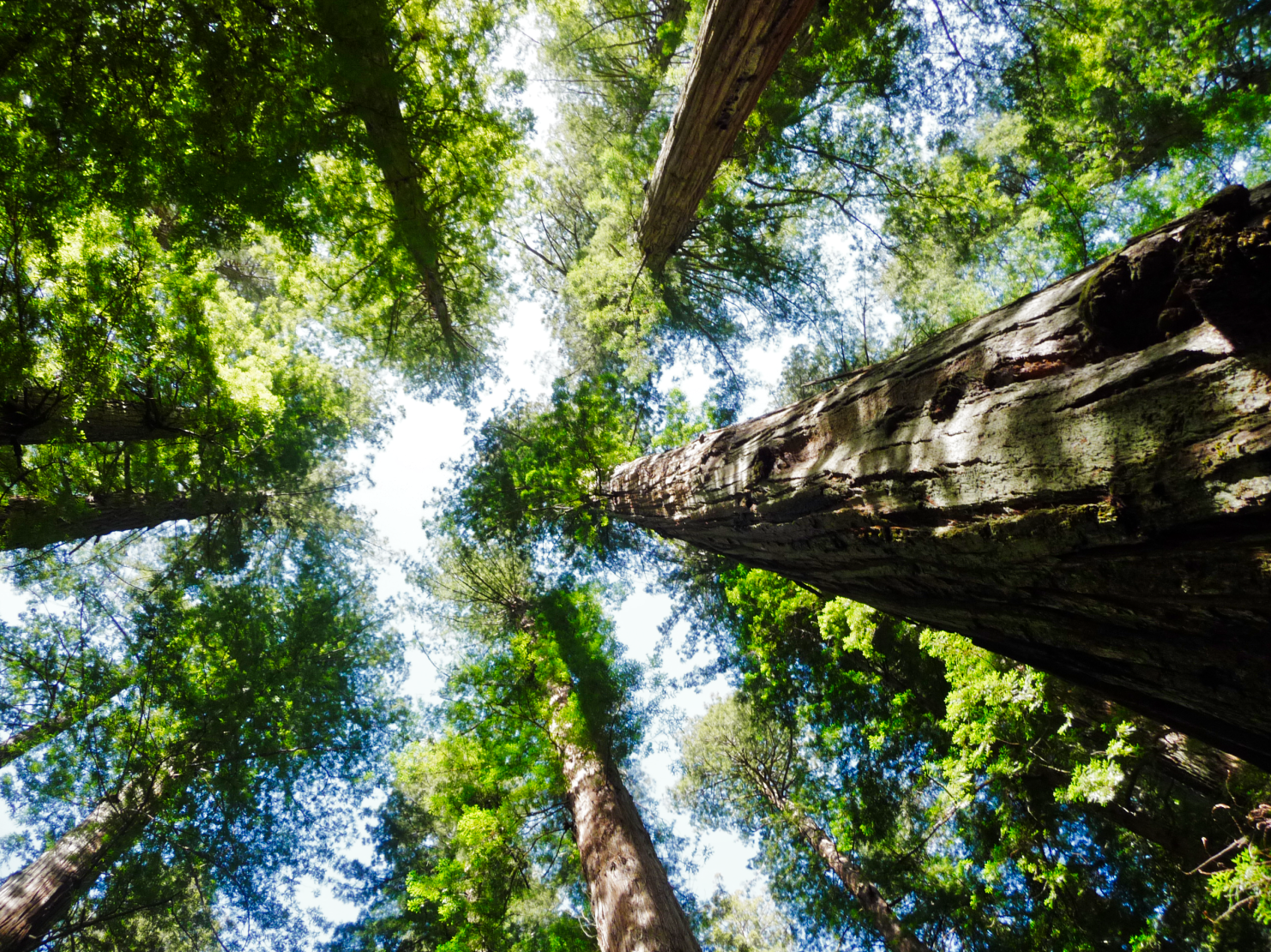
Already pretty early on the 101, I saw signs saying "Avenue of the Giants", which did totally trigger my curiosity. I took the turn (B) and ended up in an unimaginable landscape if you are used to the young forests that the Netherlands have. I felt instantly tiny and had to stop multiple times to see the size of these trees up close. At Weott (C) I turned left and started a small adventure.
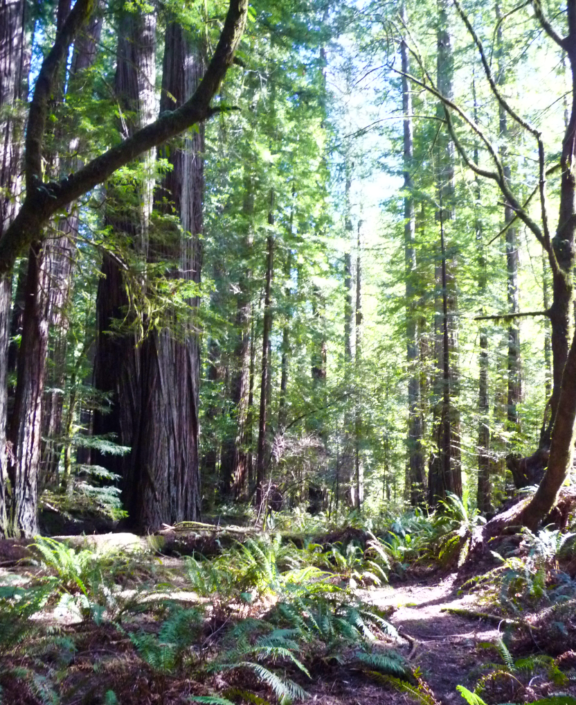
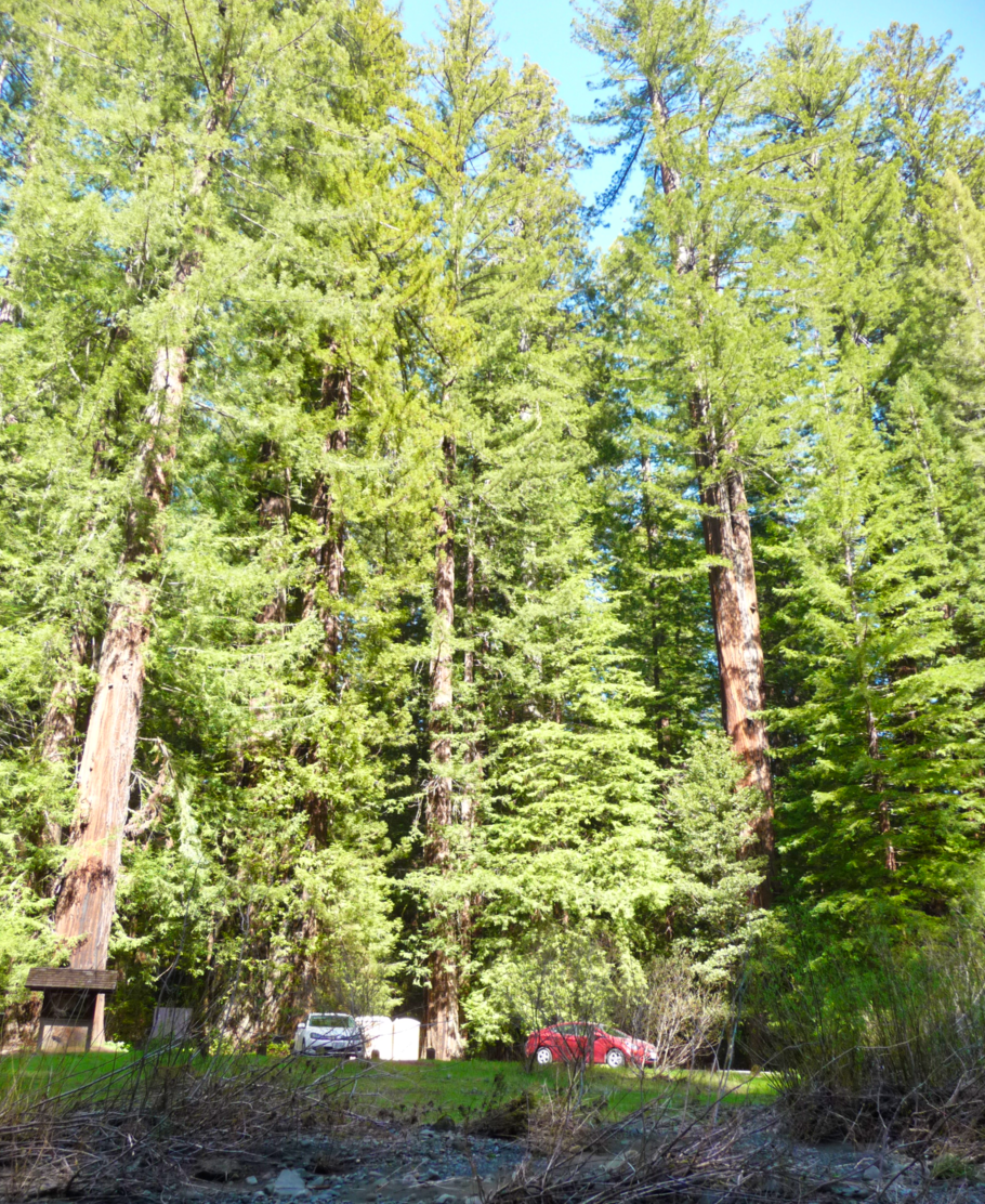
Avenue of the Giants & Bull Creek
I was on my way to Mattole Beach (D) and I was slowly running out of petrol. I am used to seeing a gas station almost every 5 kilometres, but I couldn't find any. I was in the middle of nowhere, enjoying the view and in the meantime trying to calculate if I had to turn back or if I was able to find a station near Mattole. Eventually, I found a very local station that helped me out and I could chill and continue to the beach.
Getting closer to my destination, I found the street flooded due to a nearby river and I was nervous if it was smart to continue. At some point, I wasn't able to get closer and I walked for the last bit. But it was worth it! This beach was windy and empty, apart from the dead trees lying around. But after reading the warning sign that there might be bears around, I decided to turn around and continue to Ferndale.
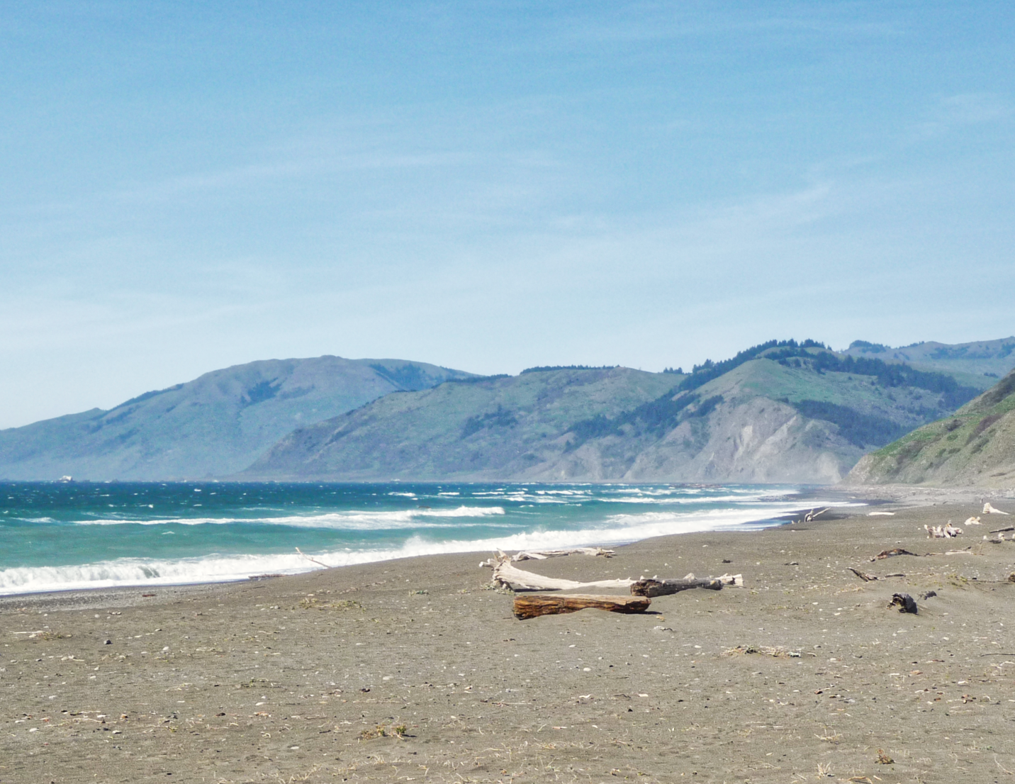
Mattole Beach
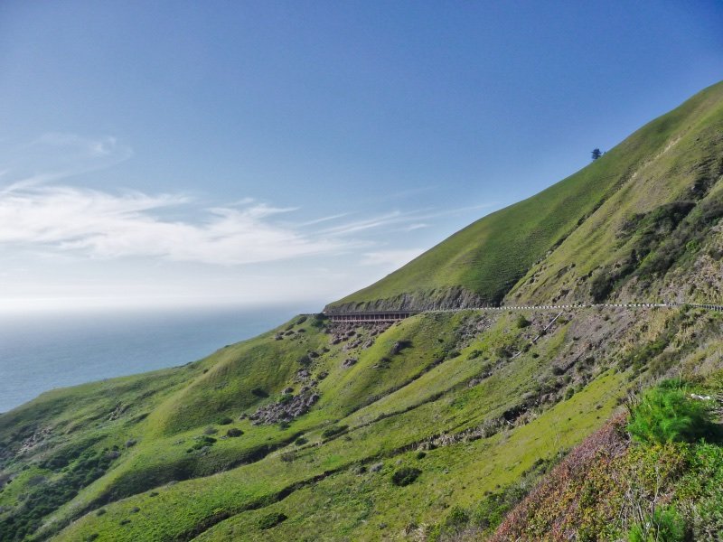
The road to Mattole Beach is a one-way street, so I had to turn around and drive back, looking for a normal asphalted road. I was driving around, not seeing any oceans, just trees and hills. And just when it started to bore me, I went around the corner and drove into the light and there it was: The ocean! The following kilometres the road followed the edge of the ocean on my way to Lost Coast (E). I tried hard not to drive into the ocean while admiring the view!
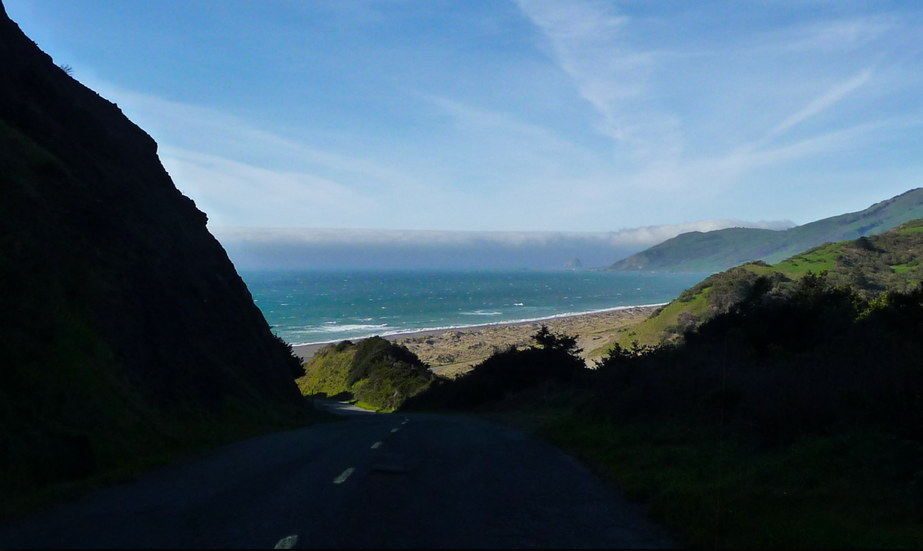
On my way to Lost Coast, leaving the shadow
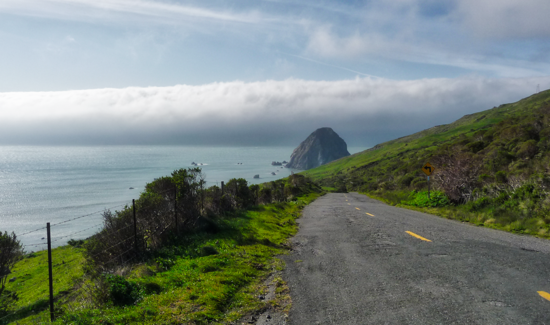
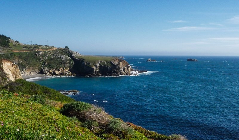
Lost Coast in the distance
At this moment, I have overdosed with impressions. I didn't stop that often anymore and I continued driving to Ferndale so I could soon call it a day. But I promised myself to visit Eureka. Which was so disappointing that I won't show you any photos of that ;) I drove back to Garberville, again taking the Avenue of the Giants. It was pretty scary in the dark but I am happy I saw it twice!!
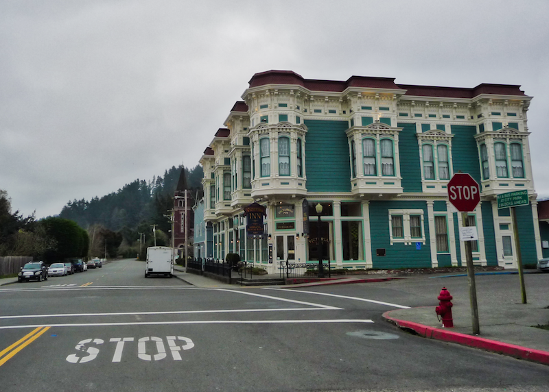
Ferndale
Sunday
Sunday route
I slept like a baby that night. And now I had to return to San Francisco. The coastal route was so impressive that I decided to continue that way. But not before I found a way to drive my car through a tree. Luckily I found one at Leggett (B)
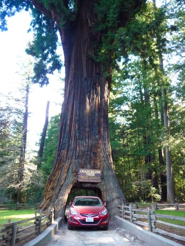
Never skip a chance to do a drive-thru
From that moment, I didn't have any plans other than driving south along the coast and see if I could find San Francisco again. The weather changed many times during this part of the trip, which was pretty odd. I enjoyed the gorgeous views in Mendocino County (although slightly sad that I wasn't allowed to come closer to the lighthouse).
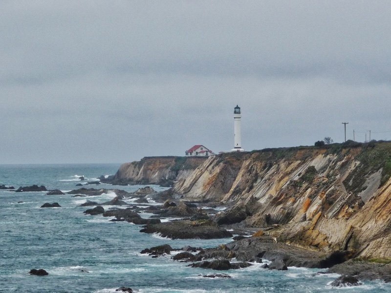
The Mendocino Lighthouse
Mendocino County
Mendocino County
Cypress Grove
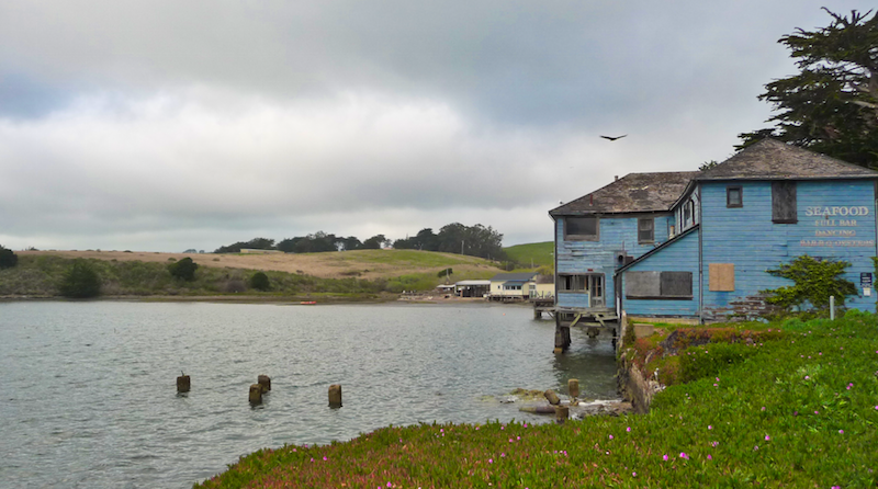
While I was driving, a friend of mine texted me to check out the Oyster bars near Cypress Grove. I don't like seafood that much and was already pretty tired. But I decided to quickly snap a picture so I could prove to him that I had been there. The Cypress Grove area is pretty amazing. Not that long after I passed the Oyster bars, I ran into a huge pile of seals in Tomales Bay.
Cypress Grove
I was getting closer to home though and just wanted to eat something, kick off my shoes and do nothing. Not that long after, I was happy to see San Francisco in the distance and I knew that I made it. Which sounds a bit over dramatic, but it was a pretty intense drive that weekend. As soon as I reached the Golden Gate Bridge, it was already dark. This gave me an amazing opportunity to take a picture of the San Francisco skyline at night. But there were so many other people trying to take that photo that there was no room for me to park my car. Or it was just an excuse... I was home ;)
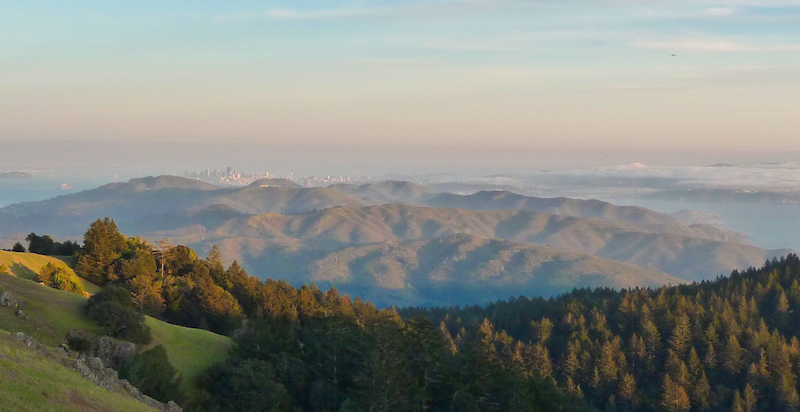
"Almost there, I can see San Francisco!!"
Sorry that this post became a little long. But the view changed so many times... I didn't know what photos not to put in here