Hello Everybody, I have an Interesting Topic tonight.
In "Jail School " the world map we were all taught to believe was an accurate representation of the worlds landmass. Nope It is not.
What we learned in school was called a Mercator map representation of the earths landmass. It is primarly used for ship navigation because it made it easier to navigate northern shipping routes.
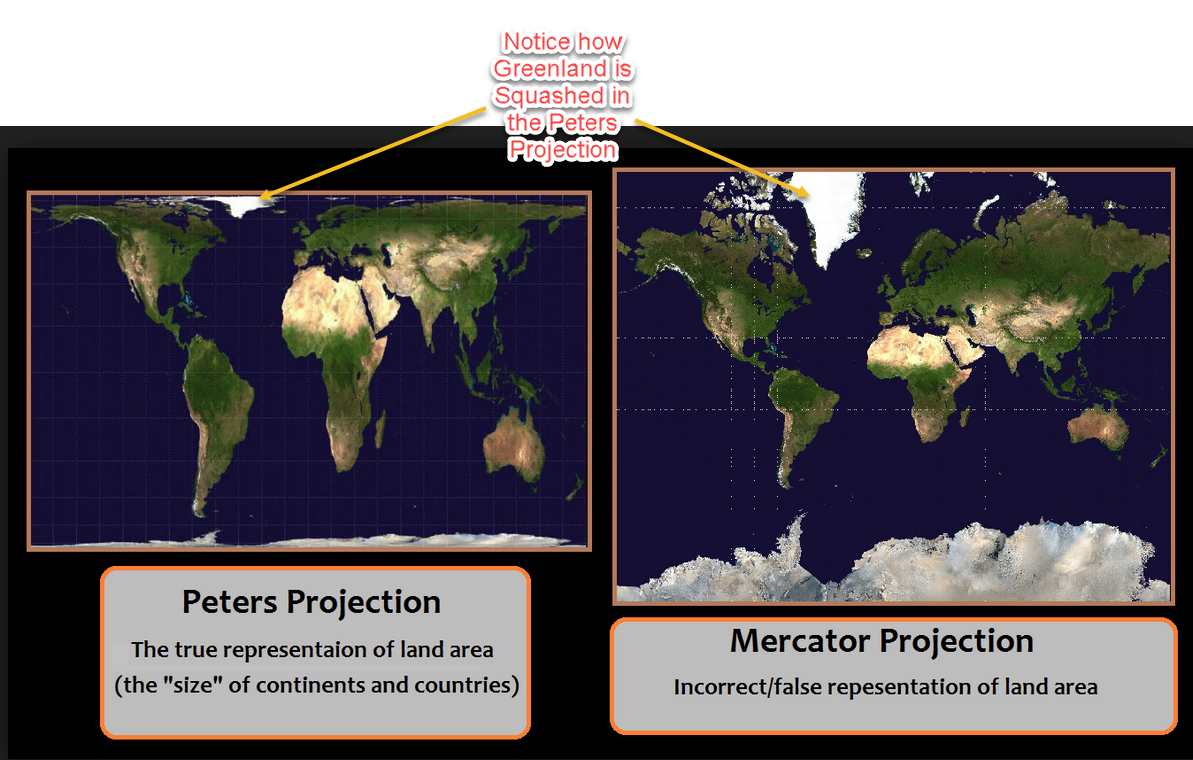
The map that shows an accurate land representation of the earth is calls a Peters projection map. It is not used for ship navigation as the poles are not stretched out like in the Mercator maps. Making Navigation on the High Seas Nearly Impossible hence the need for the Mercator map.
Geez thanks a lot Grade 3-12 geography CLASS. WTF! did we waste all our time in class for? Never hearing a peep that we were looking at a Mercator map all these years.
In a Mercator map countries that are closer to the poles get stretched out and made bigger. The closer the countries are to the Equator the smaller they look. Peters Projection Does not do that. Instead it seems to squash the polor countries smaller which better represents the true size of the country.
Here is a comparison.
Furthur Testing.
THere is a Site called www.thetruesize.com that makes comparisons, Let me show you.
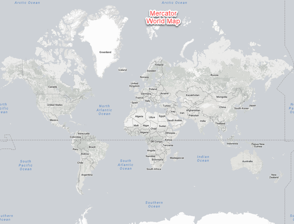
First let's do Greenland, pretending its massive at the top of the map.
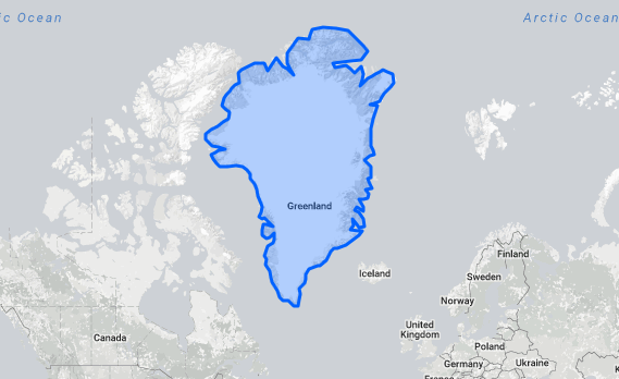
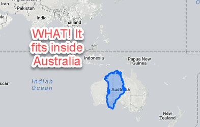
Now Let's See what Russia Does.
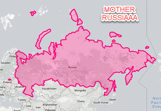
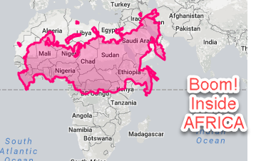
If that wasn't enough Let's take an equator country like INDIA.
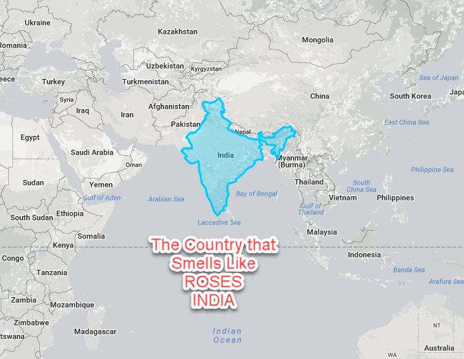
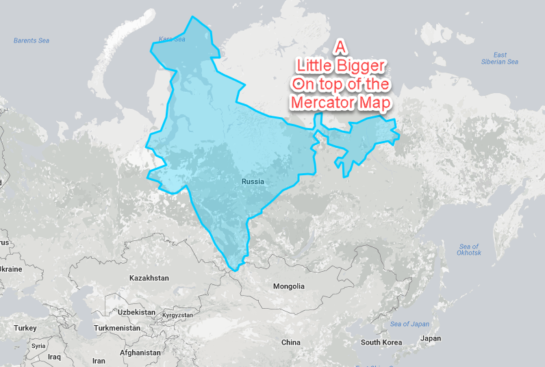
Notice how India becomes bigger then Kazakhstan.
One more Fun one for you.
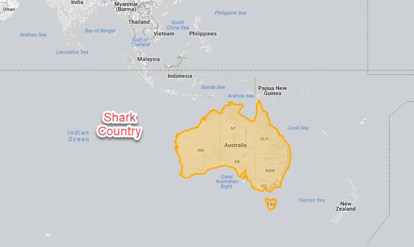
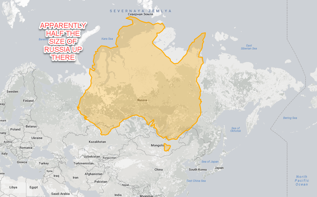
You can go to the same site truesizeof.com and play around with a whole bunch of countries.
The Real Question is. How come I had to wait for the Internet to Provide this Information? I thought I was getting an Education going to school. At least that is what I and everyone else was told.
Maybe it's time for us to start rethinking some of the concepts that we were forced taught in Kid Jail.
Anyways Hope Everyone Enjoyed this post and possibly learned something.
