"Smells like burning ass hair, cancer and desperation!" Is how Urban Dictionary describes Sarnia, Ontario. I can't really argue with the whole burning ass hair smell, due to all the chemical plants! They pretty much nailed that definition. It is so easy to point out the flaws in everything including your own hometown. It is a lot harder to find the good! That may be why I hardly blog about the city I was born and raised in. No one wants to hear about a chemical wasteland, was my opinion. It wasn't until I posted Architectural Photography - Twins!, that I realized my city has positivity! Sarnia is not only home to the incredible me, but also to many other wonderful things. I have decided to take you, my followers and friends along with me to see the benefits of Chemical Valley!
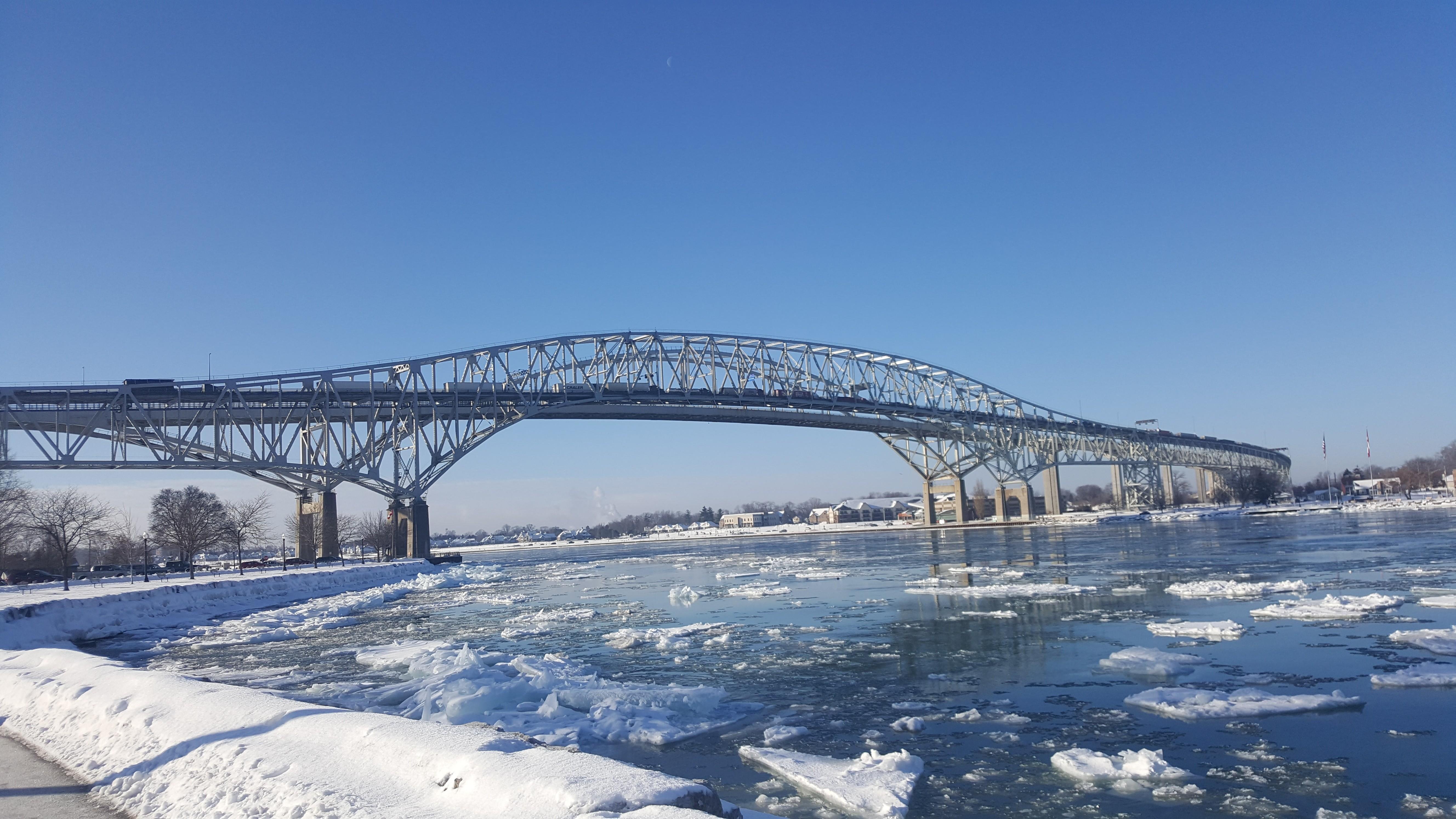
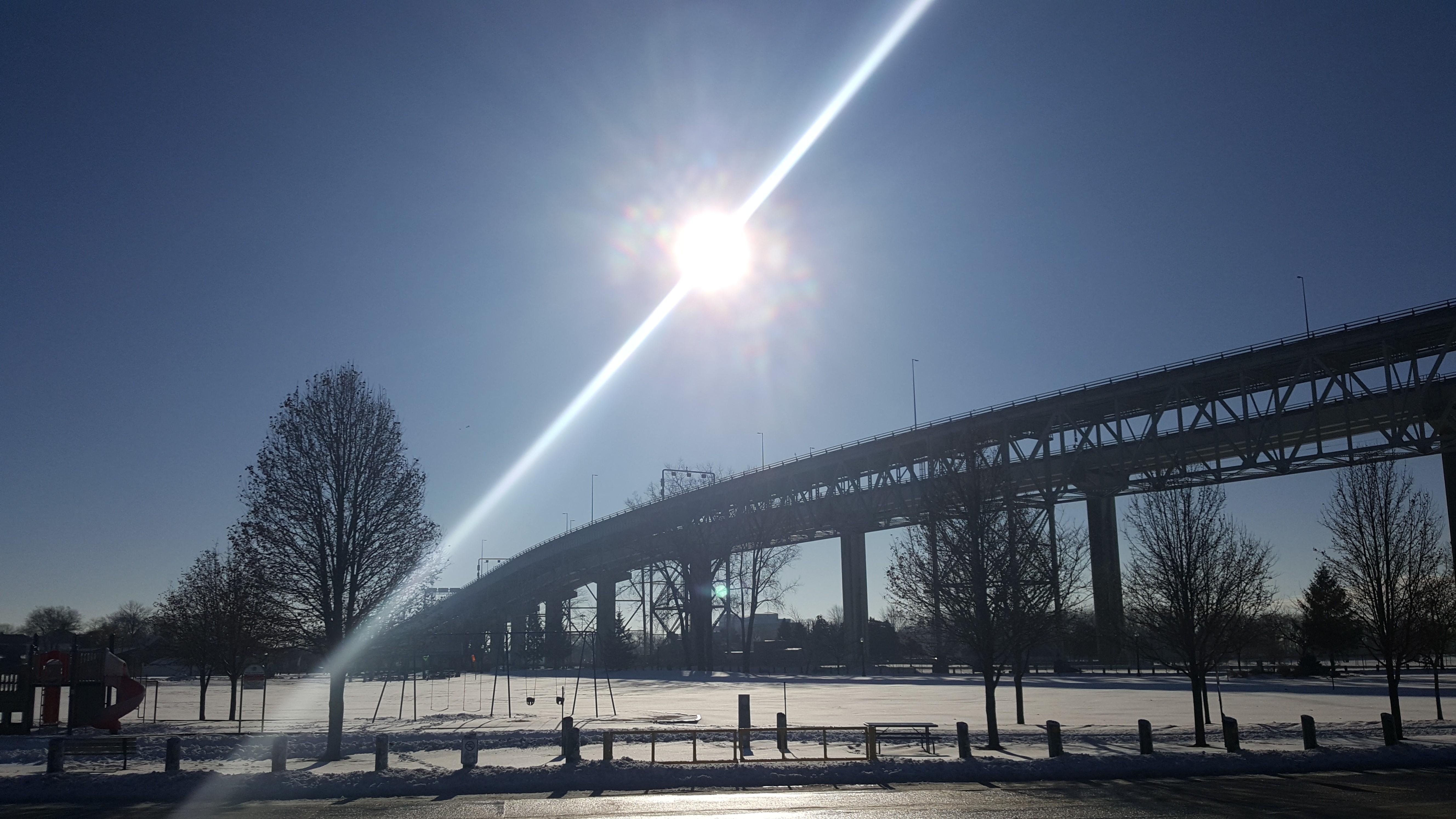
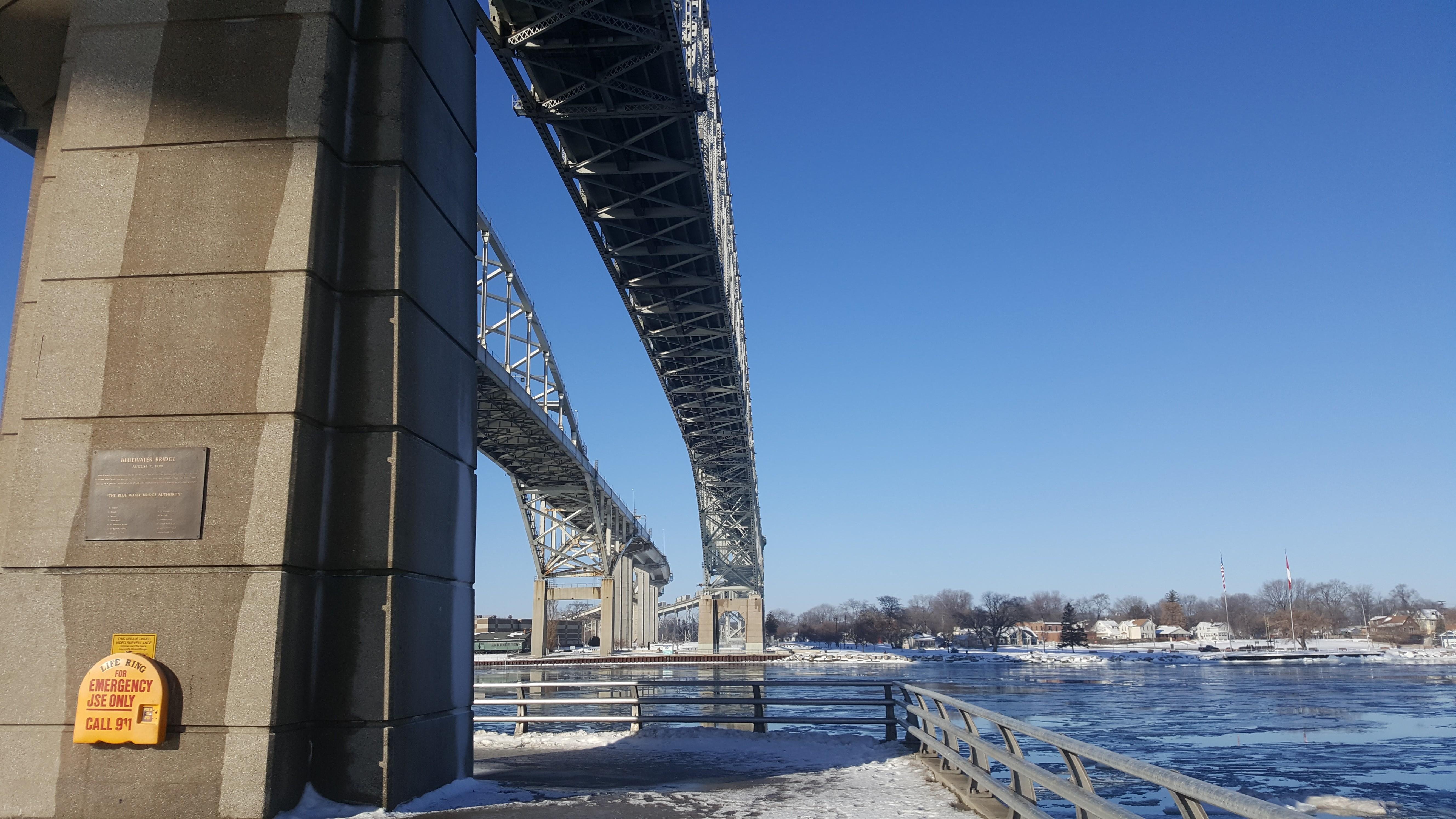
Now, If you have heard of Sarnia, usually it is because of the Bluewater Bridge! However, the bridge is not actually located in Sarnia. The bridge actually lives in Point Edward, a small neighbour town that everyone considers part of Sarnia anyway. So I decided to start with The Bluewater Bridge, since not only is Sarnia known for it but my above post prompted this whole post to begin with! The photo above started a conversation with @tattoodjay which got me thinking to do a post about the bridges! Thats right, you heard me right, bridges! I am not quite sure why we call it The Bluewater Bridge when actually there are two! Alot of people around here now say The Twin Bridges, which sounds way better to me. It may be because there was a time when there was only one bridge.
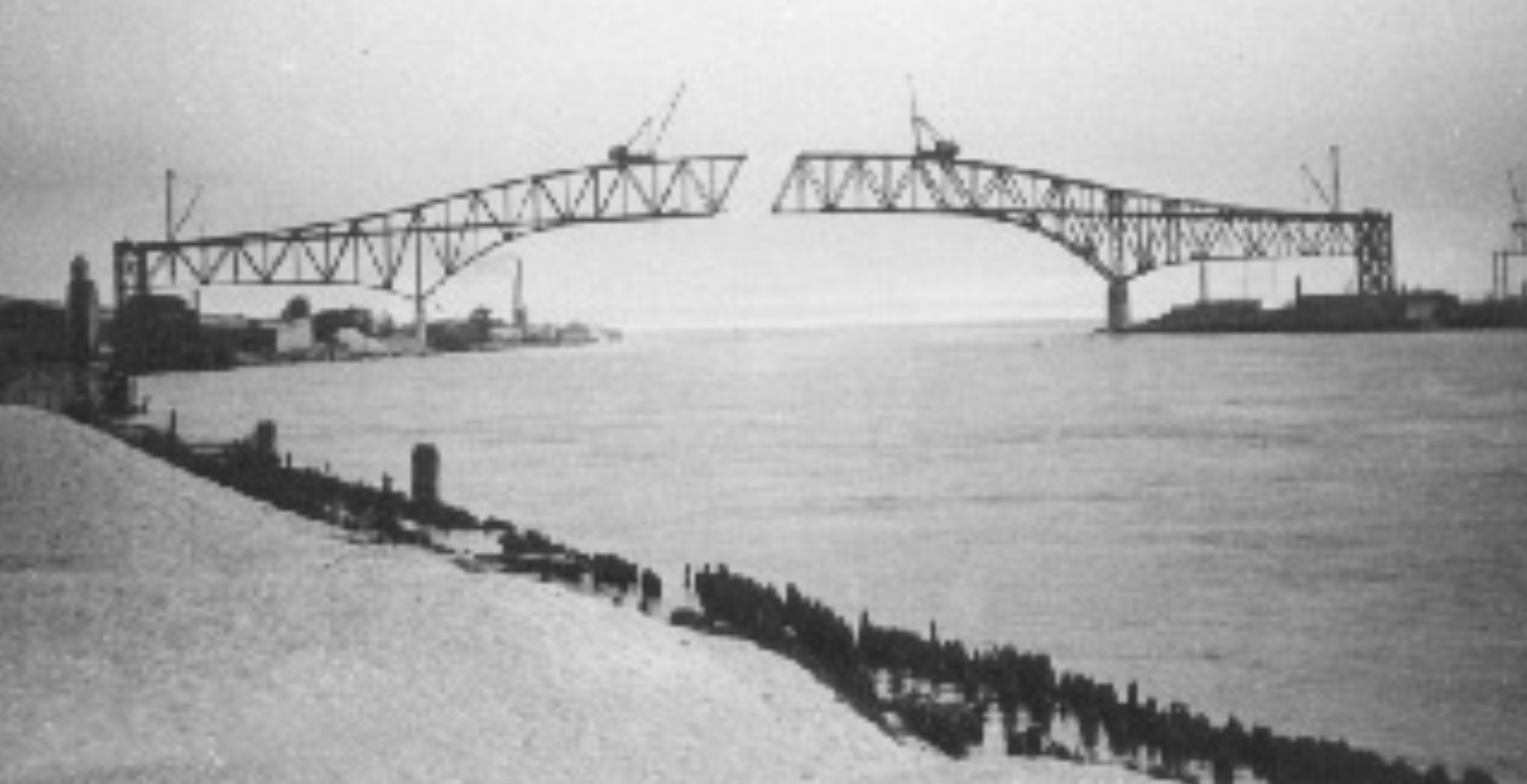
The original Bluewater Bridge was under construction from 1928 to 1938 to create a commercial crossing between countries. This was a major construction build for way back then! It was broadcasted on the news around the world. The bridge would be co-owned by both countries. Both countries decided it was best to hire Americas greatest bridge builder to be lead engineer and ensure a safe build as everyone around the world was tuning in, and there was no room for error. However, as careful as they were, accidents still happened. A riveter fell 130 feet to his death and a little girl lost her arm playing at the construction site who later died of tetanus. There are even rumors of a man falling into the concrete and many people still believe it today. Once the engineeer overcame these obsticles he still had to deal with the strict rules of the army. The shipping channel on the St. Clair River needed to remain open with at least a 150 foot clearance. After everything, the contilevee truss bridge, known as The Bluewater Bridge was opened on October 10th 1938. Consisting of 2 lanes and sidewalks the bridge was a relief to everyone. The 0.25 toll for 30 years to help offset the cost of the bridge was no big deal for people to pay, considering the convenience. The bridge became more and more popular over the years that they removed the sidewalk and put in a third lane in 1980. However, that only lasted a short 12 years before talk of a second bridge began.
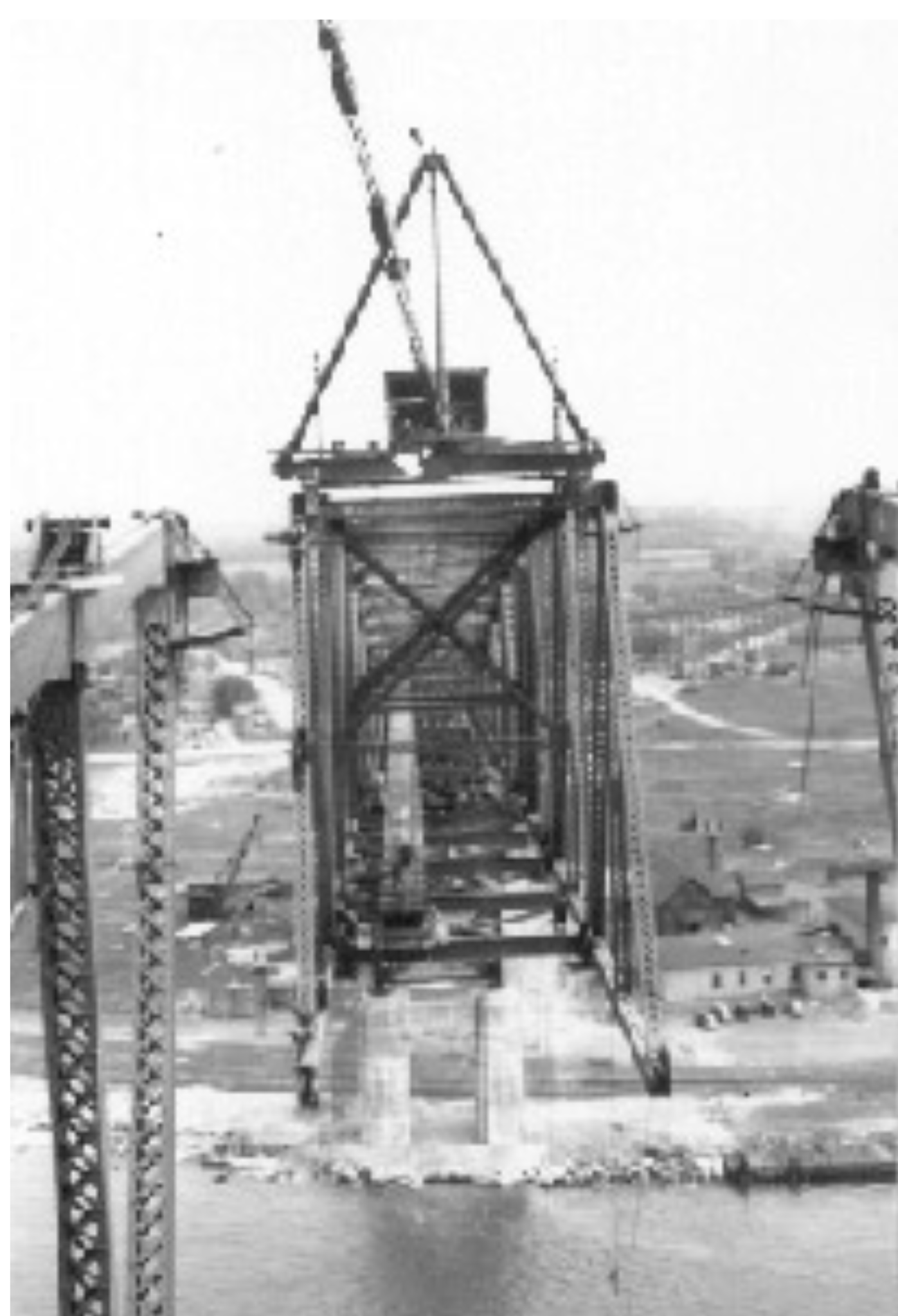
The second bridge was going to be a bowstring arch bridge. They decided to go with this type because it would look most like the original and would be more cost effective. They began construction in 1992. Wow I was only 5 years old. It really is hard to remember a time there wasn't two bridges. What was supposed to take a total of 10 years to build, only took 5. It opened on July 22, 1997.. I remember that day pretty well. If I think back it was a big celebration. They had opened the bridge to the public and allowed people to walk across. So my dad and I decided to take the trek. What is normally a short drive really is a long walk in the heat. There were people passing out from heat exhaustion. They only expected a small number of people but when the numbers grew way more than expected they had to shut down the bridge to walkers. At night they set the most beautiful fireworks display off the bridge. A time capsule full of memories about the bridge was placed with the bridge. Right after opening the new bridge they closed the old one for renovations. They re-opened it November 13th, 1999, which is now what we consider The Twin Bridges.
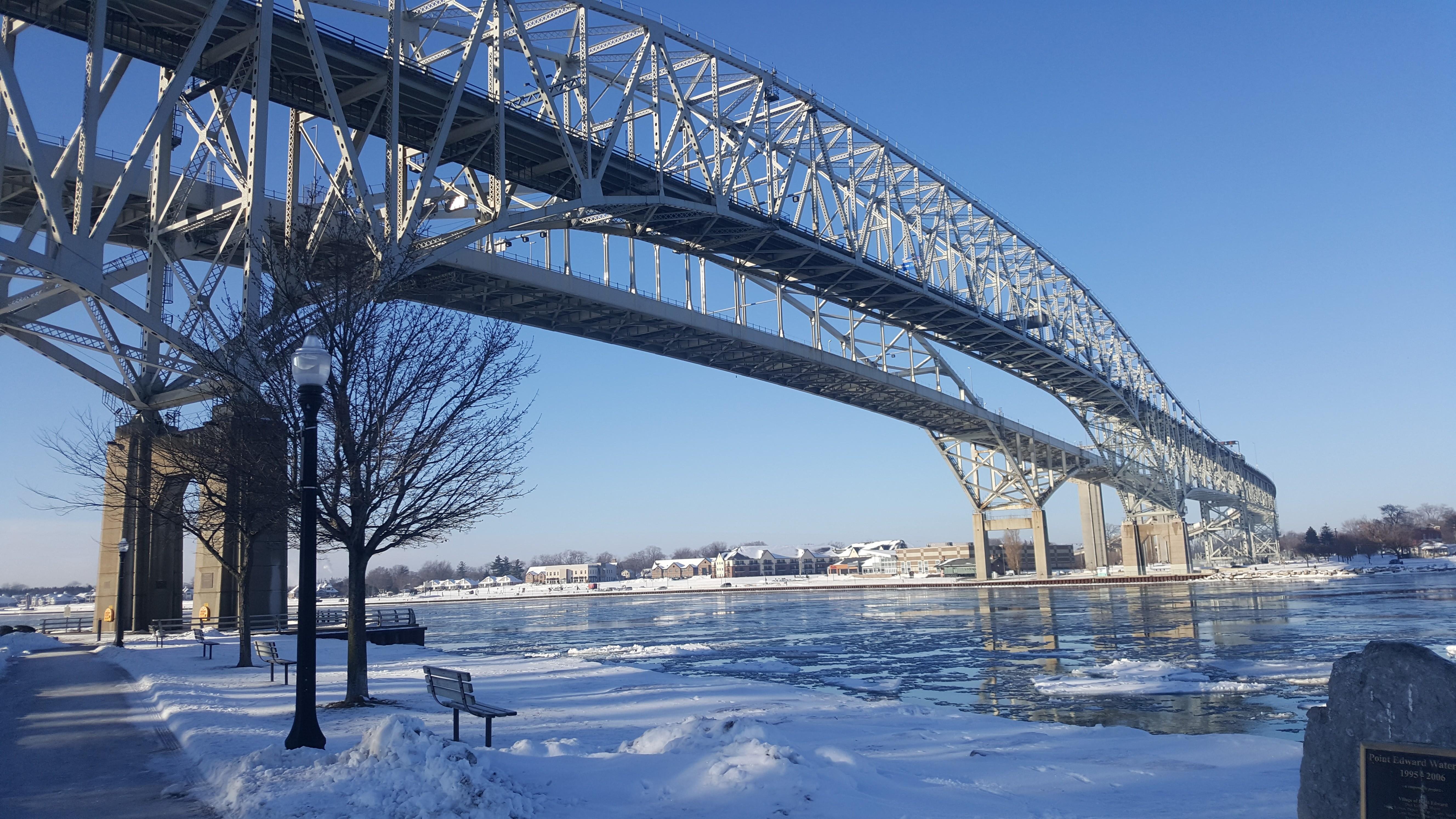
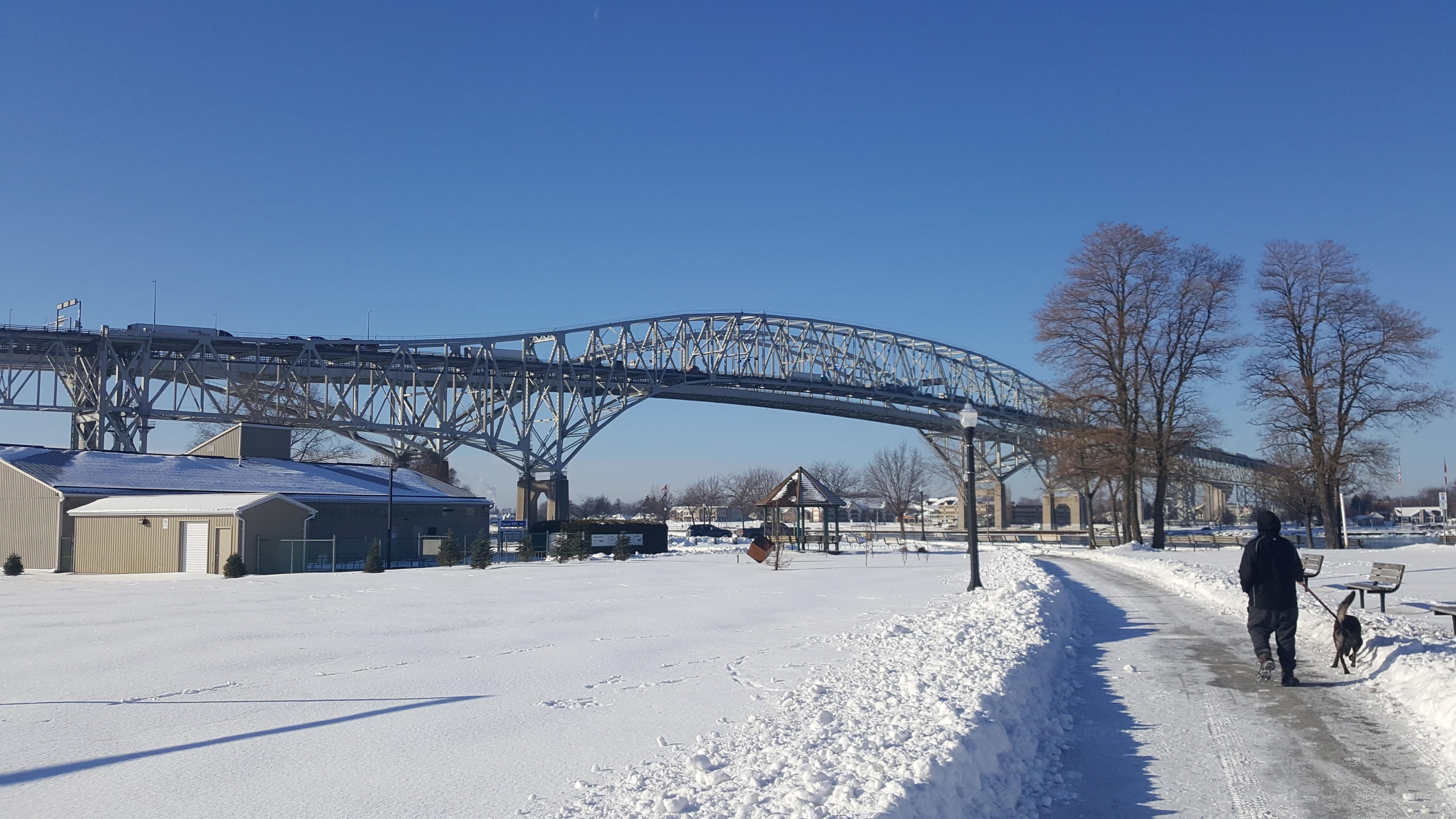
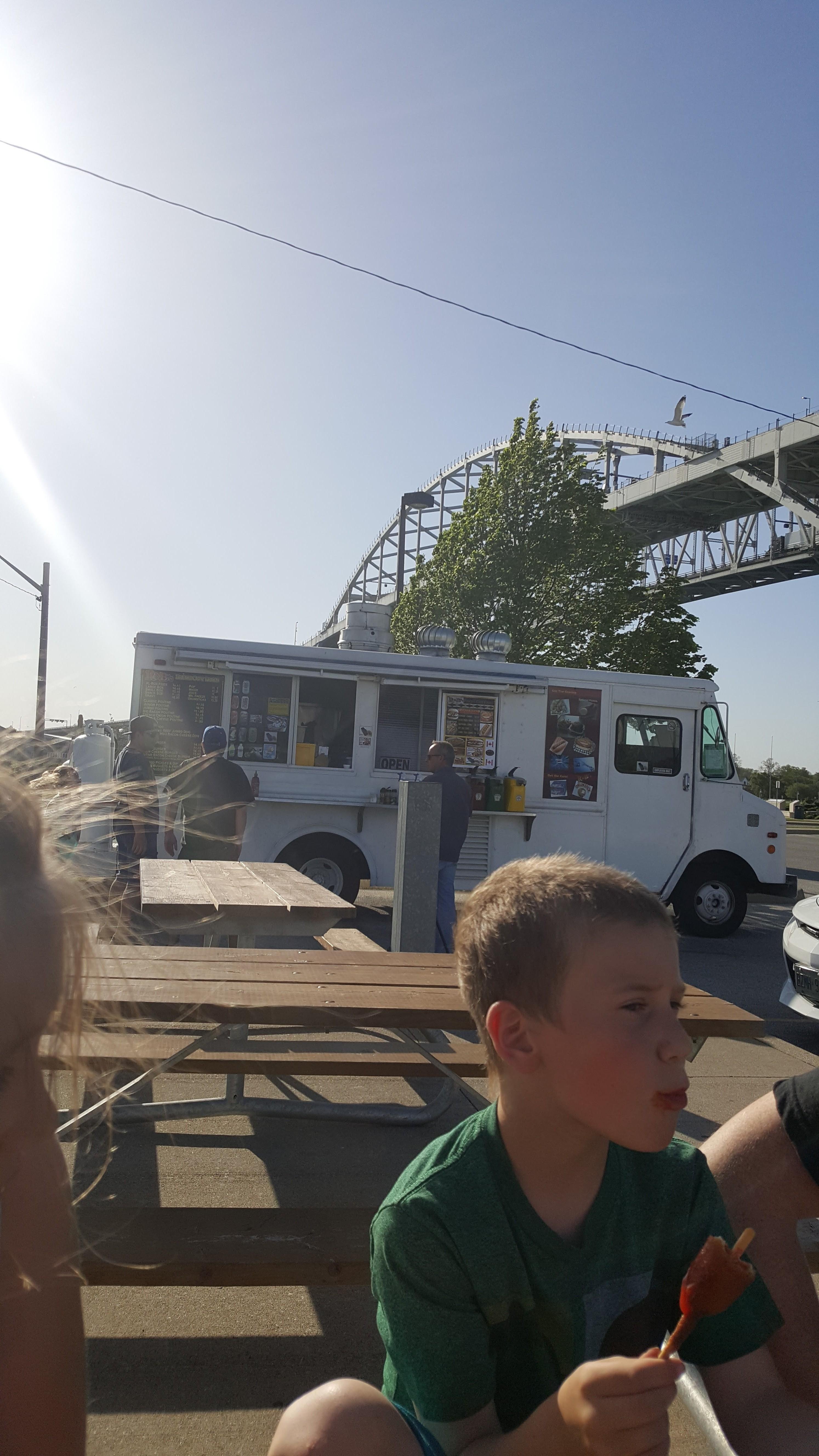
Today, the Twin Bridges has become the third most popular commercial crossing in Ontario. It sure does get busy out there, Sometimes the simple half hour drive can take a whopping all day. The traffick does get that bad! The bridge gets upwards of 4.7 million vehicles passing over it every year! After cancelling the toll at the 30 year mark of the first bridge they decided to bring it back to offset the cost of the new bridge. It is now an average of 3.00 and up depending on your vehicle size. I think they will never get rid of the toll now! They make too much money on that! At the bridges longest point, it stretches 6,178 feet. It joins the highway 402 in Point Edward, Ontario Canada with the I-94 and I-69 in Port Huron, Michigan U.S.A. 233 feet above the St. Clair River. When you think about it, that's actually pretty incredible. It is a pretty massive bridge when you are standing under it. We would know because my husband @skylineking88, children and I often go under the bridges for "bridge fries". If you have never tried "bridge fries, you should! They are a summer must have in Sarnia!
Overall, the bridge is very beautiful. It brings alot of life to our city. I know I am thankful I can easily cross whenever I want! Making it quicker to get to other parts of Canada! I was born here and even I did not know all of this information before doing this post. I had to do alot of research because before this, I just considered it an old bridge. Never gave it much more thought other than that! I am very thankful for the conversation I had with @tattoodjay, because now I see so much more! There may be a lot of crappy things about my hometown, but I am now able to open my eyes and look past all the bad and see the benefits! Which makes it a little more bearable to live in Sarnhole, the land of "burning ass hair, cancer and desperation"!
References I used for my research below.
Wikipedia
Sarnia Joirnal
Sarnia Historical Society
Bluewaterbridge.ca
[//]:# (!steemitworldmap 42.973506 lat -82.412567 long d3scr) !steemitworldmap 42.9986 lat 82.4239 long Bluewater Bridge d3scr - world map