In the summer of 2016,
I was in Vietnam with my girlfriend and a friend and we visited the most northern point of Vietnam. We had been in Vietnam couple of weeks and on the last 2 weeks of our trip we took a night train from Hanoi to Lào Cai. The train was pretty comfortable. We had a 4 person sleeping cabin and felt kind of sorry for the 4th person. We came straight from Ha Long Bay and did a pretty sweating hike there. After the hike we went straight back to Hanoi and straight to the train station, so we could not take a shower ;d. Early in the morning we arrived in Lào Cai and we took a taxi to Ta Van, a small village near Sa Pa.

A young Ta Van resident

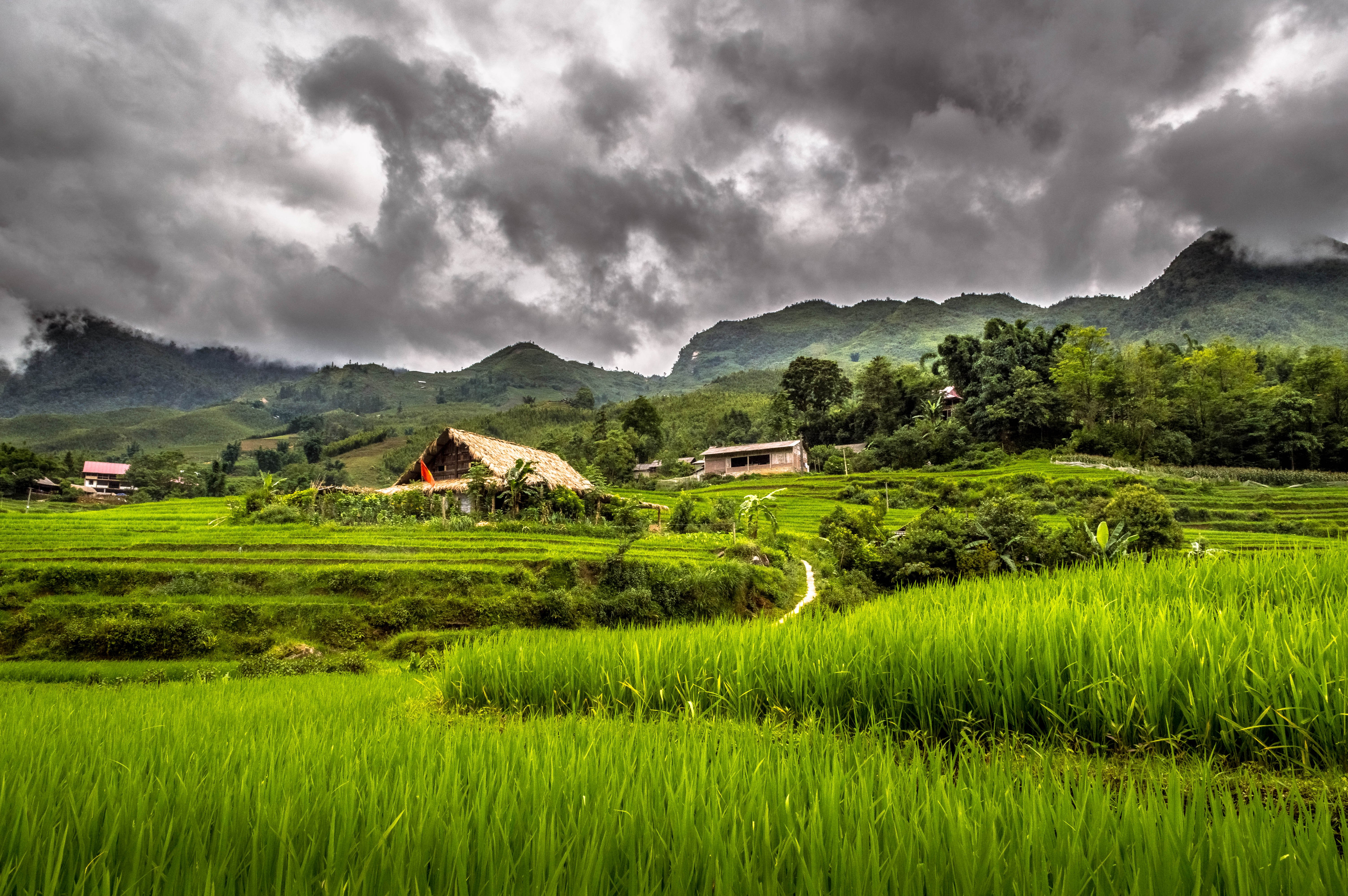
View of Ta Van during a hike

Members of the Red Dao minority. Together with the Hmong people they are the two biggest minorities in this area
We stayed there for a few days and took a cooking class and did some trekking’s. It is a beautiful place but we all had the feeling we wanted to go a more remote place (mainly because we still had a week left). Our plan was to go to the Hà Giang area. This is most northern province of Vietnam and still quite unknown to most travelers. According to our Lonely Planet there was no tourism until 2012. Sound great right. We asked the owner of our homestay if she knew how to get there. She phoned a friend who could supply us with some bus tickets and after the instructions how to get to her, we were on our way.
We took a shuttle to Sa Pa again and found the woman with the tickets. Another woman came with us to make sure we would get on the right bus. I can tell you we would never have found that bus without that woman. First we got in a minivan who just dropped us on a highway near Lào Cai and after half an hour some local bus came around the corner and stopped on the middle of the road. The woman pointed to the bus and left right after. I can tell you that bus was crammed. Not only with people but also with a shitload of food. Crazy enough it had Wi-Fi (…..) In the end it was just annoying because we kept checking Google Map. The trip to Hà Giang (the city) was just around 200 km but it took us like 6 and a half hour. The road was so bad a lot of people had to puke. Luckily the guy who was in charge of logistics was prepared and always threw some plastic bags in time to the "about to puke" person. After puking they gave the bag back and logistic man just threw it out of the window haha, crazy.

Watching a farmer during a bus stop
When we arrived in Hà Giang we got a taxi to the only hostel in town. There we asked around what we can do. Turned the few tourist that come to the Hà Giang area tend to drive this kind of circle with the highlights of the area (including one of the most beautiful mountain pass in the world, the Mã Pí Lèng Pass). We arranged a taxi for three days, which was pretty cheap, who would drive the circle with us, which would take us three days. The only drawback was that the guy did not speak a single word English. This is going to be fun.

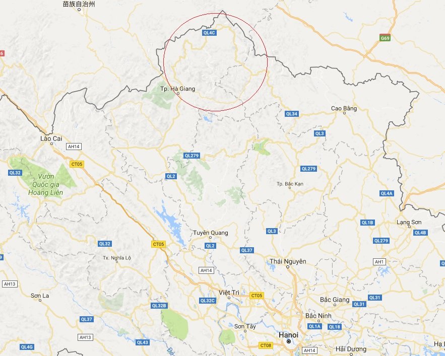
The yellow road inside the red cirle was our trip for the next three days
Source: Google Maps
The next morning taxi guy picked us up with his car and we were on our way. First we would get some money for the park entrance and then we would get the entrance ticket (for the Dong Van Karst Plateau Geopark). After some driving we drove through the entrance of the park and we never spoke of the entrance ticket again… The Dong Van Karst Plateau Geopark has beautifully views and the next days we visited caves, lookouts, palaces, minorities and so many other awesome places. The first night we slept in, I think it was Yên Minh (one thing was for sure, they selled one of the best banh mi there on the street). The second night we stayed in Dong Van.

The village of Tam Son

Vuong’s Palace. home to Vuong Duc Chinh and his son Vuong Chi Sinh during the Nguyen Dynasty. He became rich mainly by dealing in opium
The guy could absolutely not even speak a single word of English. So usually it was like: he was just driving and if I held my camera up, he stopped. Sometimes he stopped on his own and whilst smiling, was pointing in a direction. The result was that we just started walking in that direction and 9 out of 10 times we ended up on the right place (as far as we could know anyway). A few times he had to call the girl form the hostel in Hà Giang so she could try to tell us what he meant in some kind of English.
On the last day, in the morning, we went to the most northern point of Vietnam. You will find a flag tower there with a giant flag on top. You can climb the tower and it offers a nice view all the way into China (which is like 2 km’s away), cool right?
After the tower we drove the Mã Pí Lèng Pass. I can tell you that it is freaking beautiful. The Hà Giang area is so greenish and yet very rough (as in rocks and mountains).

Lung Cu Flag Tower, the most northern point of Vietnam

Driving the Mã Pí Lèng Pass

More Mã Pí Lèng Pass =)
Funny thing was that during our 3 day trip, every day we saw the same people we first met in our hostel in the city Hà Giang. We all stayed in the same villages. Apparently everyone is doing the same circle here!
Back in Hà Giang we were able to arrange another bus back to Hanoi. So luckily we did not need to take that crazy local bus again. This one was the opposite. Some kind of limo deluxe minivan with big chairs and some business man in it. But be prepared for some serious portion of crazy karaoke movie which lasts the whole trip back to Hanoi (like 5 and a half hour).
Hope you enjoyed this post! If you are interested in reading any of my previous post:
- Traveling Vietnam off the beaten track
- Visiting the Mayan National Park Tikal in Guatemala
- Hiking the Acatenango volcano in Guatemala
I am always looking forward to answering replies and reading about other people’s experiences, maybe also in this particular province of Vietnam.
Feel free to follow me and thanks in advance for upvoting any of my posts.
!steemitworldmap 23.365253 lat 105.316085 long Lung Cu Flag Tower (Ha Giang, Vietnam) d3scr
