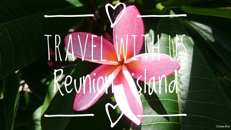
This post marks the beginning of a new travel series. After going through a slightly unexpected turn of events last week (see Post 1 and Post 2), we are now fully dedicated to our new travel project and using Steem to fuel our adventures.
We have no idea where we're going, but we're going!
As most of you now know, we landed in Reunion 2 weeks ago and have been visiting this beautiful gem for the past week.
So without further ado, here is an overview of what this island is all about.
To help you locate and get a feel for this rather small piece of land lost in the middle of nowhere, here are 2 maps which should give you a better idea:
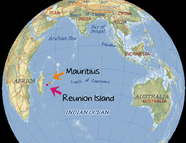 Reunion island is to the right of Madagascar | 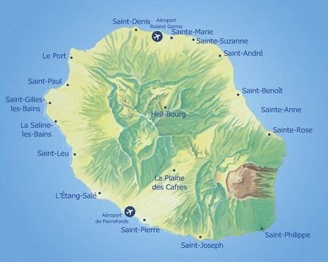 Geology of the island with its towns and volcano |
|---|
Reunion island, formerly named Bourbon island, is known for its volcanic rain-forested interior, beaches and coral reefs.
If you wish to visit as much as possible within a week or so, hiring a car is essential. The car rental companies at the Roland Garros main airport in St-denis are your best bet. We asked for their cheapest one for a week hire and got a cute little Mr. Bean style car for around 150 euros. SCORE!
Eastern part of the island and inland
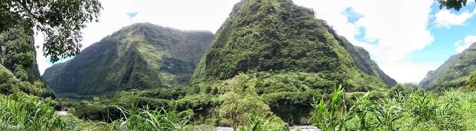
Driving up towards Salazie in the central part of the island, we were struck by the sheer beauty of the landscapes - a wonderland of waterfalls and rivers in the midst of lush vegetation. Surrounded by all different shades of green and neverending cascades, we couldn't help but wonder what the first men who roamed the island must have thought when contemplating their land.
Were they as amazed as we were?
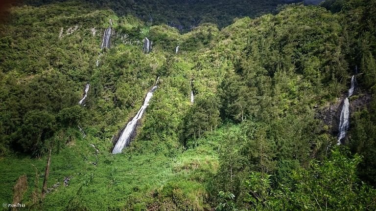
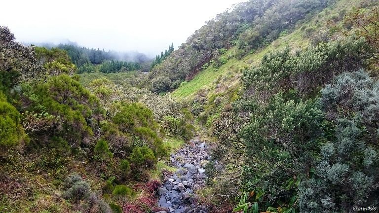
Unfortunately, as we got there a bit after noon, the fog and mist had already engulfed most of the scenery, leaving us disappointed and forced to turn around.
With a geological age of less than 4 million years and barely 4 centuries of settlement, the island offers the world a spectacle of rare singularity.
It has been recognised as one of the 25 hotspots of biodiversity in the world.
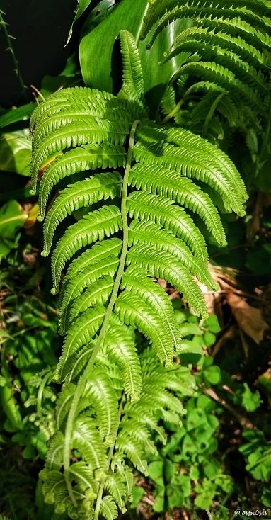
The spontaneous flora of Reunion island is currently home to 1730 species of vascular plants, of which 848 are native species. For such a small island (970 square miles), this seems huge.
More than a third of Reunion’s surface is still covered with wild plants and forests.
Hiking being one of my favorite hobbies, I found Reunion island to be a real treat as I love to observe my surroundings. If you can, bring with you binoculars or a good paparazzi lense for your camera. I don't have time to talk about the fauna but wow... never seen this many beautiful birds in one place.
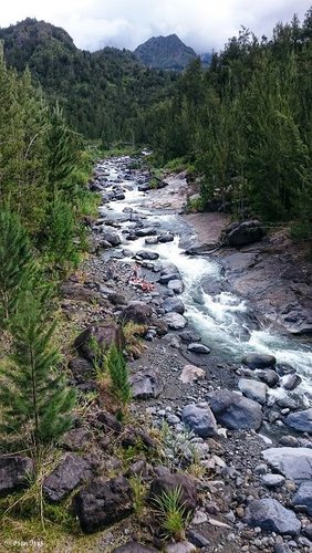 Do you see the swimmers on the left bank? | 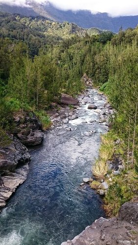 These landscapes remind me of Canada |
|---|
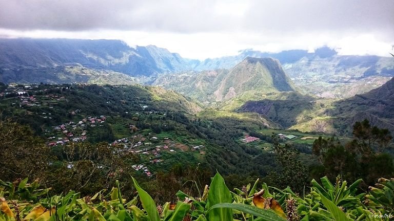
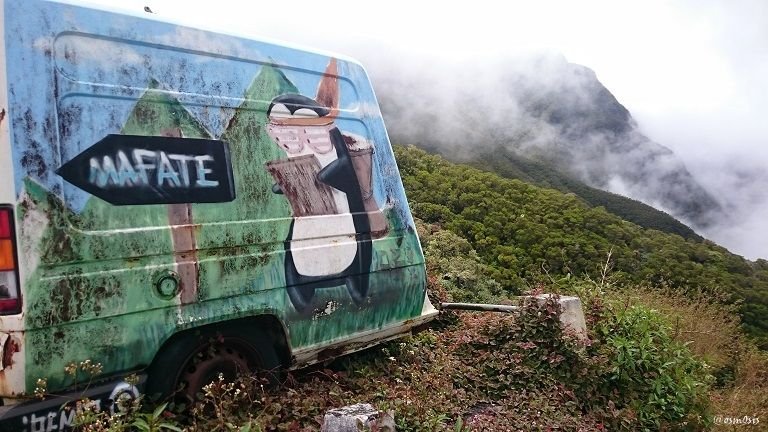
Everywhere you turn on walks and hikes, there are different panoramic views. Whether it be at the Cirque de Salazie, Cirque de Mafate, South near the volcano, or even West closer to the beaches.
Reunion island is a paradise for thrill and adventure seekers. If I had more time, I would definitely try to stay longer and focus on getting lost on the numerous trekking paths adorning the island.
If you plan on visiting, do try to stay at least 2 weeks. Unlike many of the islands I have had the chance to explore, this one deserves some time and attention. It does make me sad to not be able to live here as originally planned. I think I would have loved it.
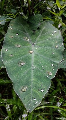 Tropical raindrops | 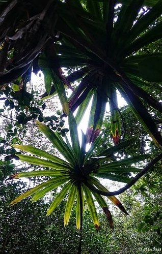 Jungle greens |
|---|
On our drive down the mountains, we stopped by as many villages as we possibly could. The care and attention given by villagers to each of their homes and gardens was a true feast for the eyes. Flowers and plants seem so carefully chosen and placed with such great esthetic taste. More on these villages in later posts.
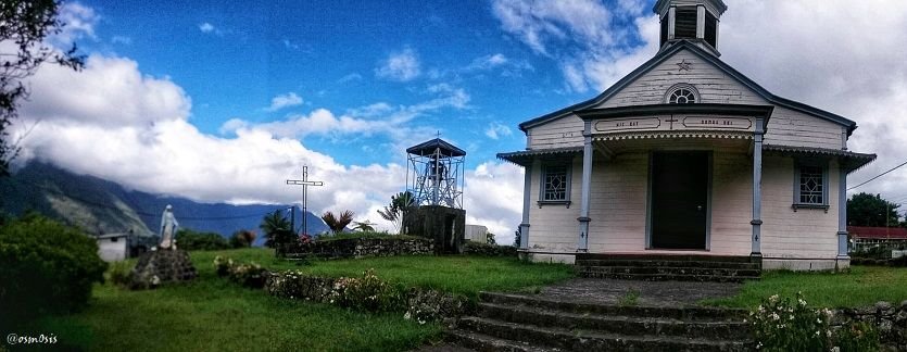
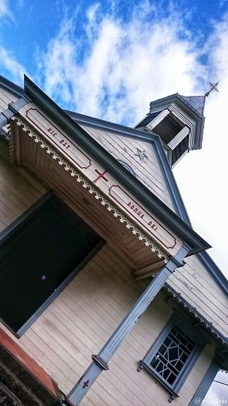
The village of Grand-îlet cultivates a rural way of living. It owes its name to a slave who fled servitude by seeking refuge on this isolated promontory.
In this particular village, an old church really caught my eye (I am not religious but there has always been something about churches that has attracted me like a magnet - it's as though I feel the ancient souls roaming around it).
The first church built in this exact same place was in 1873. Three cyclones and a few reconstructions later, the church still stands.
With less worshippers surely, but still.

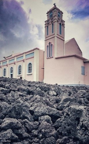 Church of Piton Sainte-Rose (East of the island) | 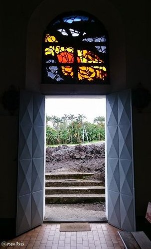 View of the lava from inside the church |
|---|
The church of Piton Saint-Rose was an impressive site to visit.
In April 1977, the village where it stands was devastated by a lava flow from the Piton de la Fournaise (volcano which you see on the South Eastern part of the map), the active volcano of Reunion island. The village church was partly invaded by the lava flow but not destroyed. It was then subsequently restored and renamed « Notre Dame des Laves » (Our Lady of the Lava).
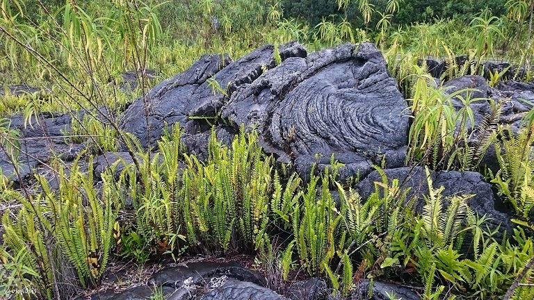
As we keep driving towards the Southern part of the island, we come across various lava flows where the volcano has erupted and lava made its way to the sea.
Above is what the lava flow of 2004 looks like today. I love to see nature slowly creeping its way back to where it left off.
Can you imagine how many layers of lava have flown and been covered up again through the centuries/millenniums?
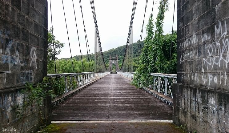

The rivers which today contribute to some of Reunion island's main towns used to be real obstacles to the economic growth of certain parts of Bourbon island.
Until 1894, walkers used footbridges to go over the rivers while ox-carts and carriages crossed on rafts which would be easily destroyed.
After a few failed attempts, this suspension bridge was built in 1892 and opened for use 2 years later. Set on 2 masonry pillars, its extensive length of cables, 61 tons of sheet iron and 25 tons of cast iron, helped withstand every cyclone and landslide mother earth threw at it.
It was used until 1979 when another bridge was built next to it.
Follow me tomorrow to walk on the pristine beaches and swim in the crystal clear waters of the West coast, take a hike on the volcano in the South, get a little tipsy at the Rum Factory, and much more!

Thank you
to all of you for following and upvoting my posts. These exciting travels and crazy adventures would not be possible without your ongoing support - I am so deeply grateful to you, my Steemit family. A super special mention goes out to my @sndbox family for providing me with the extra boost needed to even believe that such a project is possible. Kirk (@voronoi) and Michael (@hansikhouse) - you 2 are so stellar, I hope my posts do you proud.
 The treasures left behind by my great-grandfather #5 |  Our unexpected journey - Reunion Island |
|---|---|
 The treasures left behind by my great-grandfather #4 |  The fragility of life |
“Learning is not a race for information, it is a walk of discovery” - Jane Healy