"If you like the Cliffs of Moher, wait till you see Slieve League!!", someone told me. Slieve League was higher, better, less busy and just drop dead gorgeous, he made me believe. So guess what I did? I booked a weekend Donegal to see for myself!
"Up here it's different", is County Donegal's slogan. And they have a point there. Donegal is one of the most isolated counties in Ireland, only connected to one other county that is part of the Republic of Ireland. I had to take the bus from Dublin to Donegal Town and that journey took a pretty long time. As usual, it was worth it. I arrived in a lovely little town with a triangular plaza forming the town centre (that is almost it, to be fair).
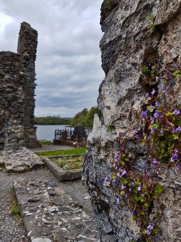
I had some time left and went to the old graveyard of Donegal, located near the water's edge. All there is left of the abbey are ruins and it isn't much. But the graveyard is beautiful. It's almost sad that the dead can't enjoy their view.
Glenveagh day trip
Saturday morning and it was time to do a day trip with Glenveagh as the major highlight.
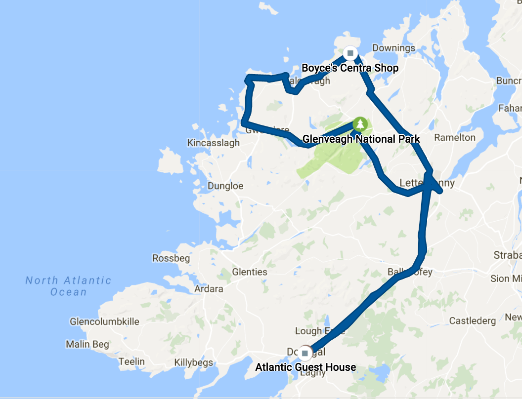
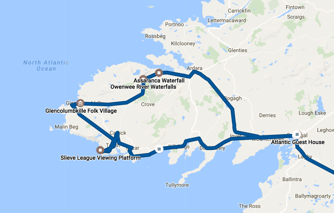
The route of that day
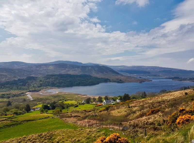
First stop was Letterkenny where a few other guests would join the trip. The next stop was Glenveagh Castle. Don't get your hopes up though. It is not really a castle, more like a huge mansion. And it's not really old, but build in "only" 1870. I wouldn't mind living there though. The location next to the lake is pretty nice and the gardens and national park in the backyard are to die for!
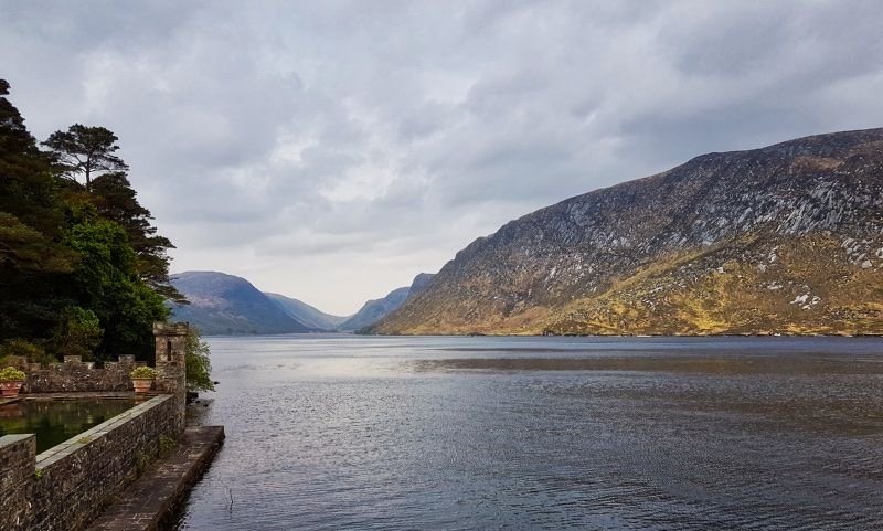
Glenveagh Castle next to Lough Veagh
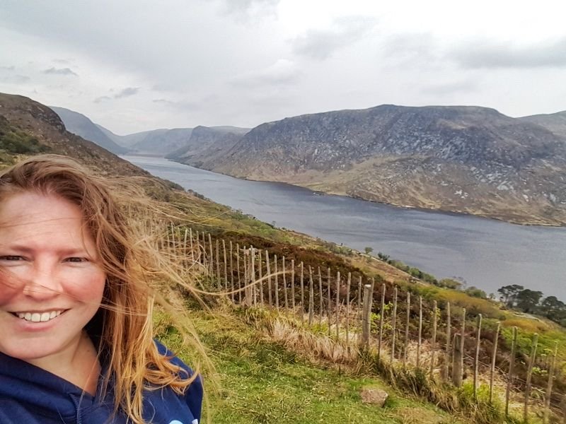
We got plenty of time to explore the castle plus national park and I decided to skip the castle and spend more time in the park. It seemed that I was the only one with that plan and not too long after I was all by myself climbing the hills to the viewing point. It was sometimes a bit of a steep climb, but it wasn't that bad to just catch my breath a little and enjoy my surroundings. And the higher I came, the better the view turned out to be!
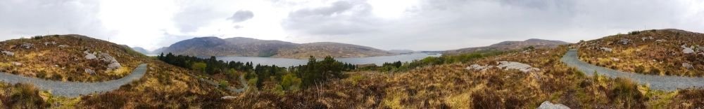
I stayed almost half an hour at the viewing point at the top. I have to admit, I was sort of dead from the climb. But there was just no-one around and the view was amazing. There was no reason to leave, except for a bus that was going to leave in half an hour. So I took a final panoramic photo and headed down on the other side of the hill, following a path that would end at the gardens next to the castle.
Glenveagh National Park
Our bus wasn't much of a bus. We were with a pretty small group which made it very cosy and more interactive. The driver was very patient with us, stopping whenever one of us wanted to make an extra photo and thinking along what other points of interest there could be for us. When we passed the small village of Dunlewey I started fantasising about owning a small house here. Having these views, just some sheep and all the peace in the world.
Dunlewey (repost)
Dunlewey is located at the foot of Mount Errigal, a 751-meter high mountain that really stands out in the area. Many people hike this mountain, but we decided to skip it (I don't think it was an option anyway).
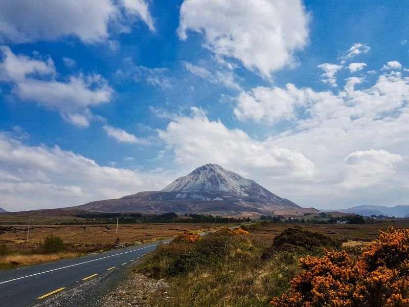
Mount Errigal
The guide had better plans. He would drive us to Magheraroarty Beach (don't you love these Irish names?). This beach was particularly nice with the sand dunes separating the beach from the swampy back-land. It is remote enough to be almost empty when we were there. It was too cold to think about sunbathing there, but I think it would be amazing in summer. After exploring the beach we dropped some people in Letterkenny again before going back to Donegal Town. Tomorrow the second part!
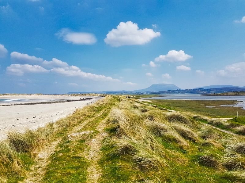
Magheraroarty Beach
Slieve League Cliffs day trip
Day two we would visit Slieve League, the reason behind my trip to Donegal. The same guide as the day before would pick us up. The group was even smaller than the day before!
On our way to Slieve League, we passed Muckross Head. It is a small peninsula popular with surfers and rock climbers. From a distance, the small enclosed beach looks lovely!
Muckross Peninsula
We arrived at the highlight of that day. It wasn't a surprise that it was going to be gorgeous since on the winding road there, we already saw many amazing views. Now that the door was opened and we're free to go, we couldn't wait.
There is a bit of a touristy platform at the cliffs. They sell ice cream (really nice!) and local homemade stuff (do I come across not impressed?). I was most happy about a girl sitting there with a few lambs and goats.
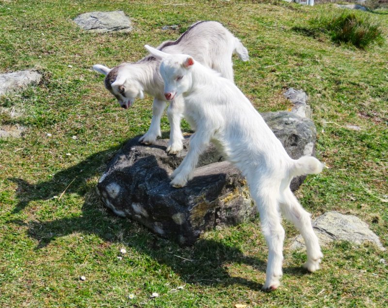
Goats
But there was no way around it. The viewing platform was up the hill and it was steep enough to need some form of stairs. It was busier than expected, but nothing compared to the Cliffs of Moher. It was easy to find a spot on the edge and take a photo of the cliffs.
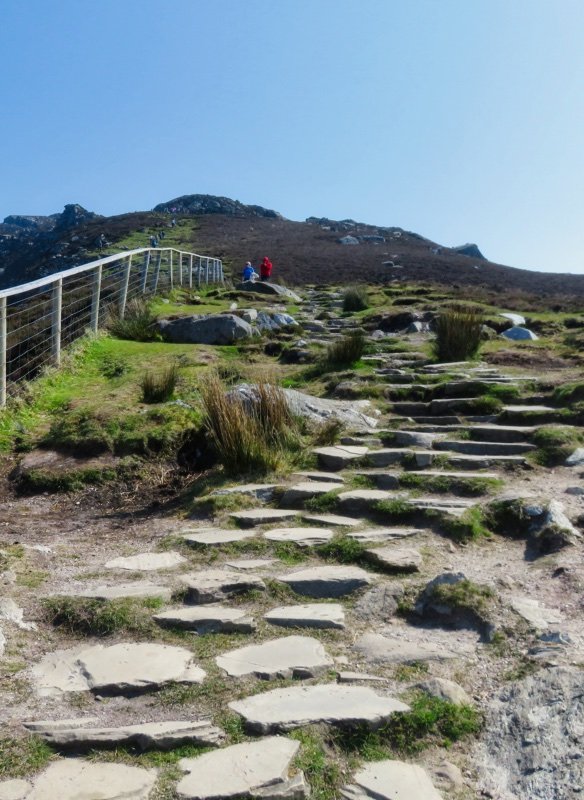
Walking the stairs
It took me some time to get to the viewing platform since I ran out of breath a few times. Maybe you can't tell from the photos, but these cliffs are three times as high as those at Moher. From the viewing point, it is possible to go even higher, but they suggest to not go for this option if you lack hiking experience ;) Looking further up the mountain convinced me. The viewing platform was good enough!
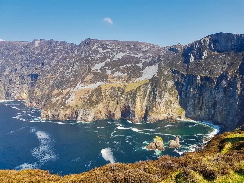
The Slieve League view
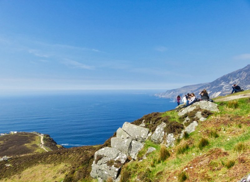
Enjoying the view
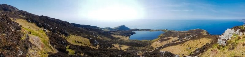
Panoramic view Slieve League with Lough O'Muilligan stuck up the mountain
There isn't really much to add here. It was gorgeous and it was high. Just a tiny thing that the guide showed us before we left. Close to the parking lot the letters "RE" are formed in the hills. This used to be the letters "EIRE" and was a way to inform pilots during WWII that the land below was Ireland. Ireland declared themselves neutral but didn't mind helping the pilots navigating. Around Ireland, there are about 85 of these signs.
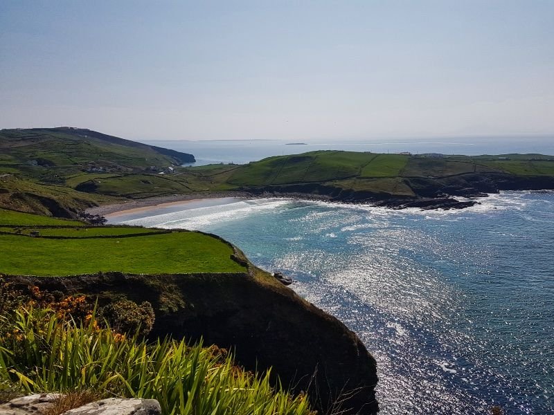
After Slieve League we were tired and hungry. The guide thought he knew the perfect spot, Glencolmcille. The Folk Village Museum wasn't really my cup of tea. The typical local cottages looked nice but it was all a little too set up. Educational for children though. I decided to grab a sandwich and find a spot near the beach to eat it.

On our way to Glencolmcille
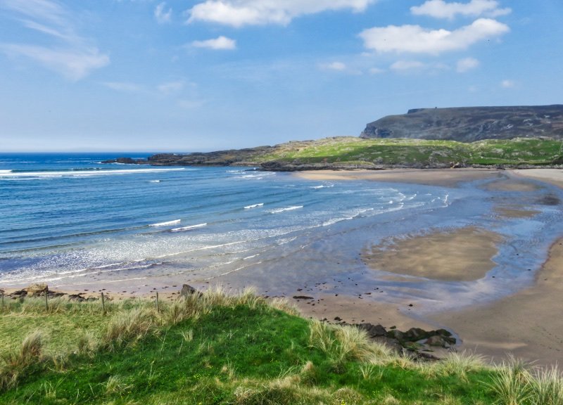
Glen Bay Beach near Glencolmcille
That day the weather was so nice that our guide decided to treat us with a little extra. He took the slow detour to show us the view of the beautiful valley near Owenwee River Waterfalls. We didn't see any waterfalls there though, being so distracted by this view. The guide's wife started texting that she assumed that he was going to be late since he was probably in the valley. And she was so right. After the valley he quickly showed us the Assaranca Waterfalls instead and then it was time to return to Donegal. Where I had to get on the bus to Dublin again...
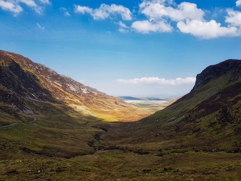
Valley near Owenwee River Waterfalls
Also in this series:
Ireland & the back arse of nowhere #1: Aran Islands
Ireland & the back arse of nowhere #2: Cliffs of Moher
Ireland & the back arse of nowhere #3: Gap of Dunloe & Lakes of Killarney