This is my Hobby
Astro-cityscape photography
I have picked up a hobby to photograph the setting sun through the St. Louis Gateway Arch monument every day of the year, weather permitting, from a precise distance for effect. I was inspired to do this after seeing "Dramatic Moonset — Amazing Sight on Cerro Paranal, Chile, Home of ESO’s Very Large Telescope (VLT)". As amazing as the photo is, was the amount of information provided with the photo that started me on my own hobby.
This project started a few years ago and will continue a few more. I moved into a home with access to view the Gateway Arch from across the Mississippi River floodplain, known as the American Bottoms. I became interested in finding locations to photograph the monument during the sunset with a relatively close size relationship.
I have lived in St. Louis all of my life and knew the size of the arch, how it was built and much of the culture that surrounds it. I am an engineer by practice, and wanted to figure out how wide the sun is at sunset and compare that to how wide the Gateway Arch is from any distance and at any location on the ground. That means I had to figure out the angular dimensions of each.
I went to the Wolfram-Alpha website to calculate the angular diameter of the sun during sunset. The result is only a little more than 1/2 degree (0.534°) or 32 arc seconds. Then using CAD to draw the base dimensions of The Gateway arch and extending lines that converged at the same angle (0.534°) to get an idea of the camera distance. This measurement was 49,500 feet, or 9.5 miles / 15 km. I also used Google Earth to a set date and time with the sun location turned on to help scout locations throughout the year as the sun changes position each day because of the Earth tilt. With this information, I determined a 10.5 mile range of locations that I could photograph from ground level, but on the edge of the floodplain bluff so that I was over the tree tops.
The circles in the image above represent 6 to 9.5 mile radius' in half-mile increments. The skewed line from north to south is aligned with the legs of the monument. The horizontal line to the east represents where the shadow of the arch will be on the spring and autumn equinox. The line to the north-east represents the winter solstice and the line to the south-east represents the summer solstice.
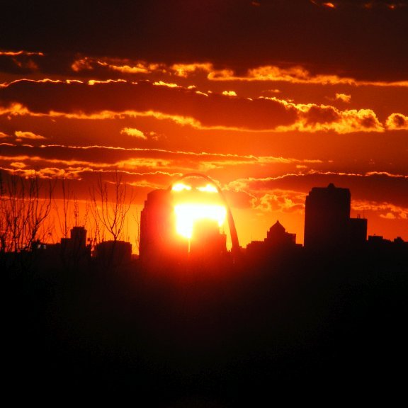
My first calculated location attempt was a success!
I decided to make my first attempt in the first week of April when the spring temperature was comfortable enough to set up and photograph for about one hour. I did not have eye protection like a welders helmet or ISO rated eclipse shades. I only used the digital eyepiece of my digital camera to point and shoot so that I would not damage my vision. The resulting photo below was only one out of about 80 photos I took, and it was spot on! I extracted the EXIF metadata and superimposed it onto the image for my proof of work.
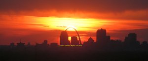
Click for large image
Since my DSLR does not record GPS data, I also snap a few photos with my smartphone to capture the location data, then chart these locations on Google Earth desktop. I can then return each year to the same locations.
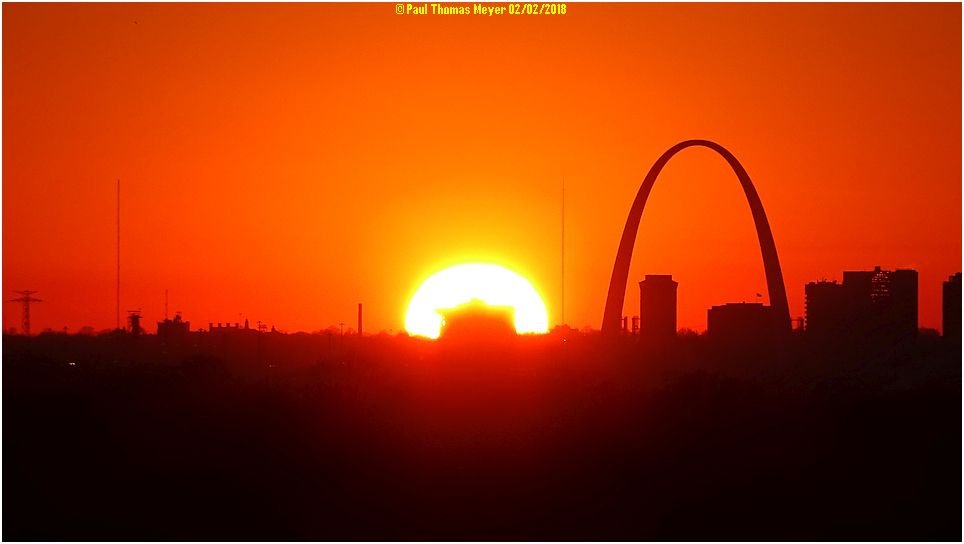
The locations that I photograph from are usually along a public road or adjacent easements so I have not had to request permission to be on someone else's property, except one. Since the Gateway Arch is not built on a due North-South line, it is built to match the old St. Louis street grid, I extrapolated the line out to the east and found a home that was located directly in the path of the centerline of the arch and street grid. I did a public information search of the address and found the name of the resident, which was handy when I visited and introduced myself to ask permission to be on their property.
This photo is from their front yard.
Click for large image
I will need to adjust my location to the north if possible to be able to align the monument with the old buildings along the centerline. I will also need to visit a few days earlier so I can capture the sun centered with the arch, but the weather is a big factor when going out.
My camera settings have been experimental to attempt different effects, and from slightly varied locations from day to day to see if the sun's elevation has a better effect for silhouettes with the buildings. St. Louis has generally high humidity levels that create the deep orange and reds in my photos. Sometimes the humidity is so high that the haze completely obscures the sun. Sometimes I can be set up and taking photos for 30 minutes when a layer of clouds ascends over the horizon and mask the sun for an incredible effect, like this one.
I intend to get a better camera body and lens for greater resolution photos and better quality zoom and enlargements. A longer term goal is to use a remote flying drone that I can navigate over trees from more precisely calculated distance photos.
The following are my blog posts of my hobby.
- I had calculated that the width of the arch legs closely matched the apparent diameter of the sun from this distance. : @bcuda69/20171222t220440845z-post
- I captured over 500 still images to create a timelapse. Posted on DTube. @bcuda69/7jriiyr4
https://steemitimages.com/300x300/https://ipfs.io/ipfs/QmPQKo4MEU8TFE7DJLk9kEoWP1Qh3zW3Q6cAayJQ9oVyi2
- This is my most extensive time-lapse.
@bcuda69/7yzk7ys0
This blog post is my entry to the @anomadsoul contest found here, @anomadsoul/contest-my-2018-this-is-my-hobby-or-100-sbd-in-prizes