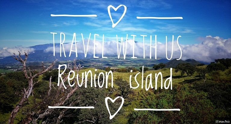
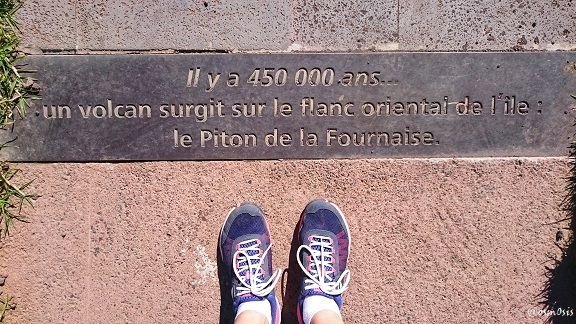
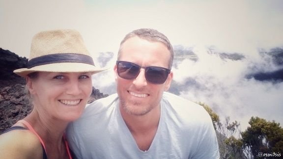
A trip to Reunion would not be complete without a hike to the "Piton de la Fournaise", one of the world's most active volcano along with Kīlauea in the Hawaiian Islands, which I had the great privilege to see when I was a teenager - and still remember to this day.
Literally translated to The Peak of the Furnace, its most recent eruption began on the 14th of July 2017, just a few months ago... yikes! Let's hope the furnace doesn't decide to turn itself on any time soon.
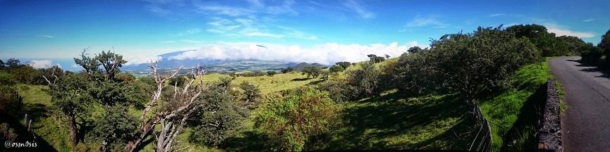
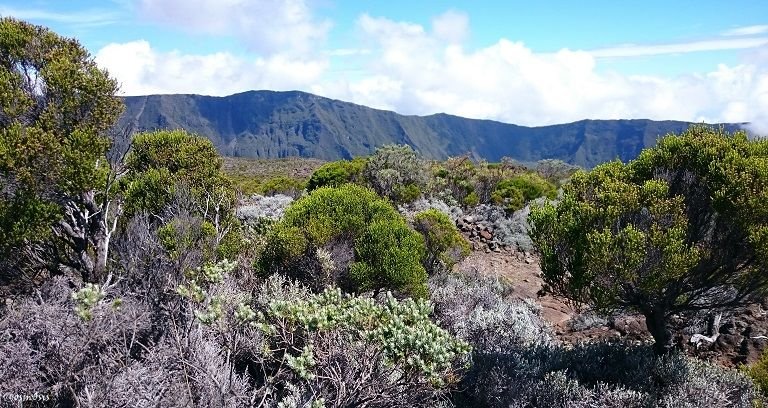
As we begin our drive up the mountain, we discover a beautifully lavish area displaying multiple shades of green.
Each turn we take on the winding little road brings us closer to the clouds.
This time we remembered to get an early start so as to beat the foggy/cloudy weather which often sets in from noon onwards during this time of the year.
The good part of being in a DOM-TOM (the island belongs to France and is considered a special region) is that the roads are excellent! I am used to island roads being very beat up, if not completely potholed... but here, it looks like the French government has made an effort. Yaaaay froggies!
As we get a bit closer to the volcano, we enter an area called "La Riviere des Remparts", which looks like the Grand Canyon but just a bit greener :)
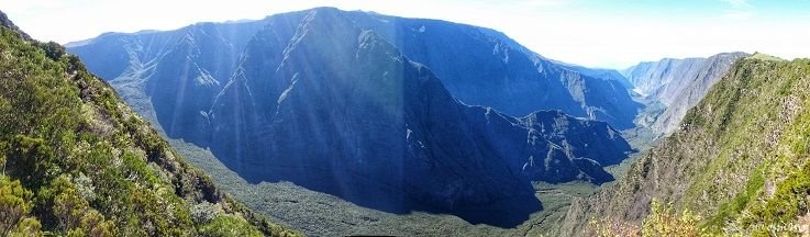
The bottom of the valley was covered by lava emitted during the eruption of the Commerson crater around 2,000 years ago. The lava flows are still identifiable in the upper part of the valley where the river still follows old underground lava tunnels.
It was very impressive to stand at the top of this gigantic canyon - with no tourists around. Just us and the rest of the world!
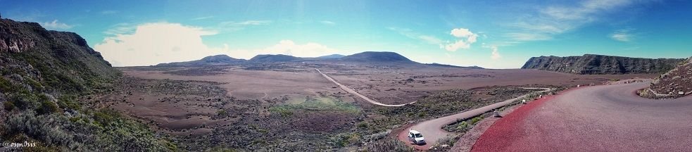
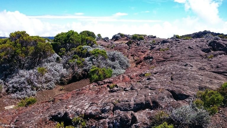
As we continue our drive, we begin to notice the gradual disappearance of flora. We turn around a corner and BOOM! We've landed on the moon.
The photo above shows the vast area called "La plaine des sables". One must drive through this strange landscape devoid of any vegetation in order to get to the volcano. Asher (@abh12345) and I had a lot of fun bouncing up and down the potholed road. Had our car not been a piece of s***, I would have had an off-road field trip!
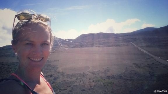
I had planned to do a trek in this area, recommended by the lovely lady from our guesthouse - but after stepping outside for just a few seconds and seeing how very little shade there was, I opted for a big fat raincheck and smiled at the thought of not getting a second degree burn that day.
Looking at the super detailed map she lent us, the volcano wasn't too far anyway. We would have to keep our strength, effort, and mostly water (!) for that hike anyway.
On arrival, just a few minutes later, we are struck by an endless space of desolate emptiness.
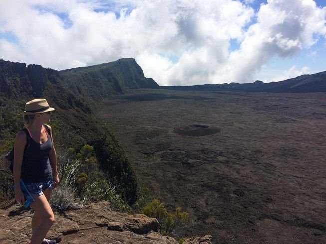
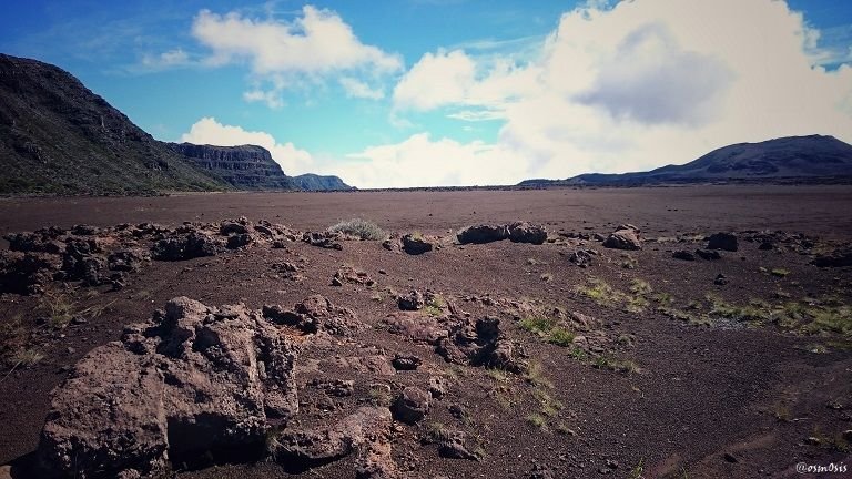
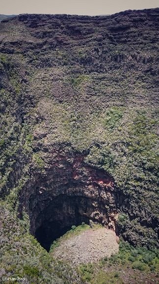
The small crater you see to my left is called "Formica Leo", named after the fact that when you look at it from up top, it resembles an ant hill - if you stay long enough to observe a few walkers following its path, you will notice how very little they look and remind us of tiny ants.
And hold on to your butts people, because this is exactly where we are going!
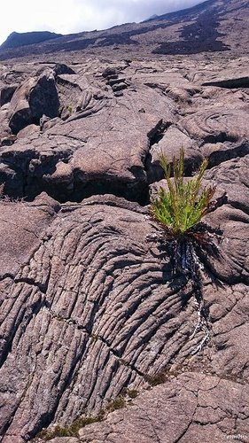
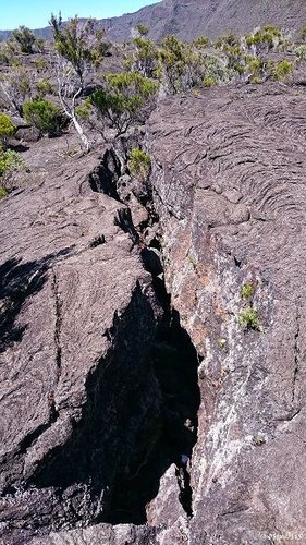 Lava crevices | 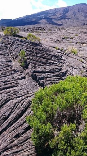 Petrified lava flow |
|---|
The walk down a narrow winding path to "Formica Leo" is done in maximum 15 minutes. It is a bit shaded thanks to its cliff, so I am cherishing these last moments of protection before being burnt to death on the crater!
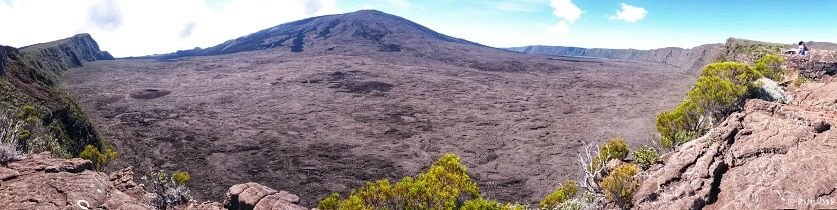
Once we arrive, it is a strange feeling to think that this area was once covered in molten hot lava (and could still very well be).
If you look closely at the 2nd photo above and 1rst photo below, you will notice the different/darker colored lava flow coming down the hilltop. It is from the most recent eruption, in July last year.
We did play the awesome game of "The floor is lava" but, unfortunately, everyone lost.
 Nature always finds a way | 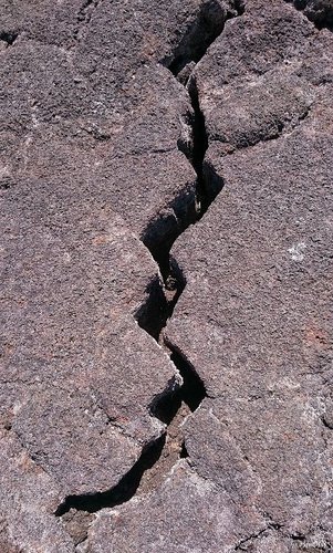 Lava lightning bolt |
|---|
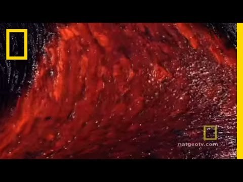
To give you a sense of the beauty of lava and its endless flow of fire, here is a short Youtube video, an extract from NatGeo TV which I find captivating. If only we had witnessed such an amazing rarity....
I walked a bit further from Formica Leo to get a closer look at the core of the crater called "Dolomieu". This time, it wasn't a cute 15-minute walk... but much, MUCH further - and steeper.
Unfortunately, my pale skin is so prone to being sunburnt (even after applying 3 tons of cream and wearing as many hats as I possibly can) that I opted for a safe return, already fully satisfied with what I had seen and experienced.
The hike back up the crater took us about 25 minutes, and a good liter of water ;)
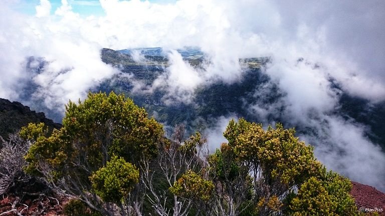
On the drive back we stopped to take a few photos and admire the landscapes one last time. It's not every day you get to be on top of the world!
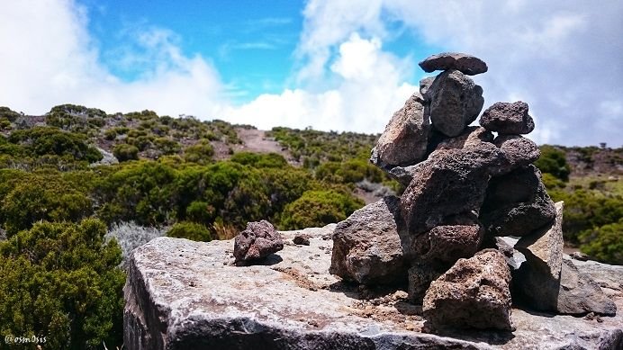
I even found the time to make a cairn with lava rocks. It was a special one, with a strong base and a bit messy, as I couldn't get them to stay put. Lava rocks can be extremely light due to numerous air cavities (but also very heavy, which wasn't the case here).
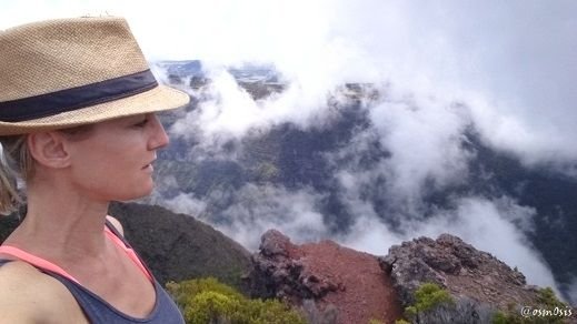
Just before starting our descent back down the mountain, we noticed the clouds slowly moving along the cliffside and stopped once again.
We were greeted with a breathtaking show of the elements. In the background of the cliff, rain was beginning to appear, while downwards, slowly creeping up, were clouds - huge cloud formations and wind. When I learn how to share videos with you on Steemit, I will definitely have to show you this amazing phenomenon we witnessed.
It felt as though the mountains were saying goodbye.
The photo you see below may look like African landscapes. Rest assured, no antelopes or elephants were seen roaming these grounds (although I would have loved to see some).
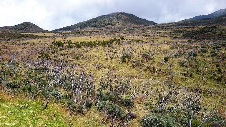
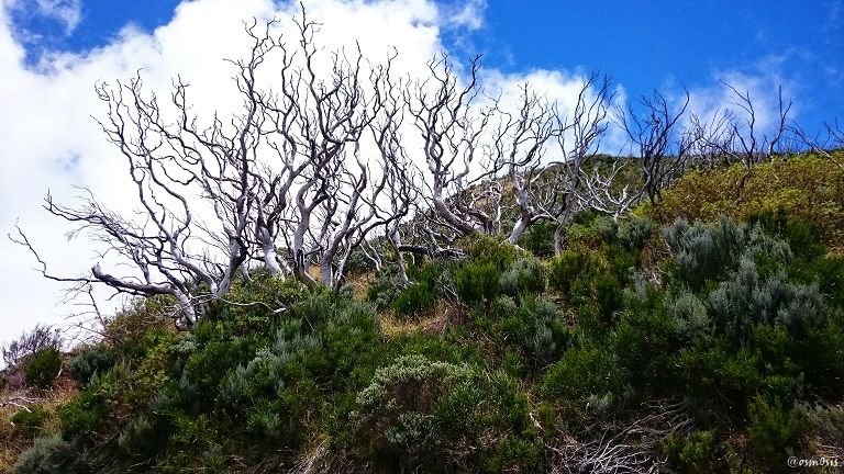
These wiggly trees are some of the first signs of the return to a more prominent flora. Their mouvements remind me of Tim Burton trees... I wouldn't want to walk through this area at night.
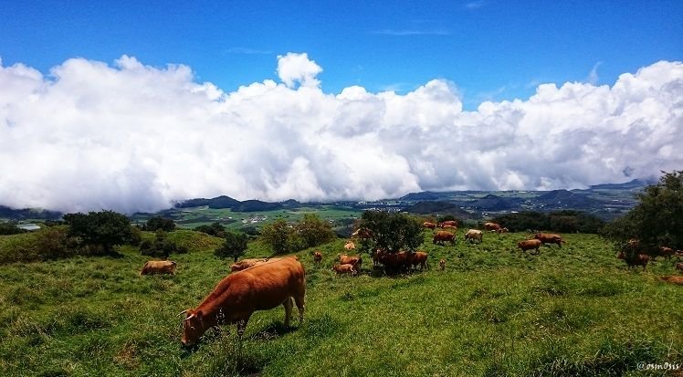
We reach our final level of elevation with the lower mountainous areas which, surprisingly enough, had cows and pastures. Asher and I were so confused we thought we had been transported to the Swiss Alps for a moment to be with @steemitri. But Alas! Our favourite mannequin was nowhere to be found.

 My great-grandfather and Burgundian houses |  ICE challenge |
|---|---|
 Our unexpected journey - Reunion island 2 |  Our unexpected journey - Reunion island 1 |
“Learning is not a race for information, it is a walk of discovery” - Jane Healy