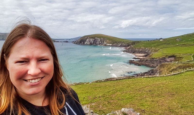
It was Easter weekend and Friday morning I had taken the train from Dublin to Killarney. I had serious plans this weekend. Sunday I would do the Ring of Kerry and Monday was going to be Gap of Dunloe time. But first I was going to explore Dingle Peninsula, the most northern peninsula of County Kerry in South-West Ireland. And this day was going to have a little surprise in it!
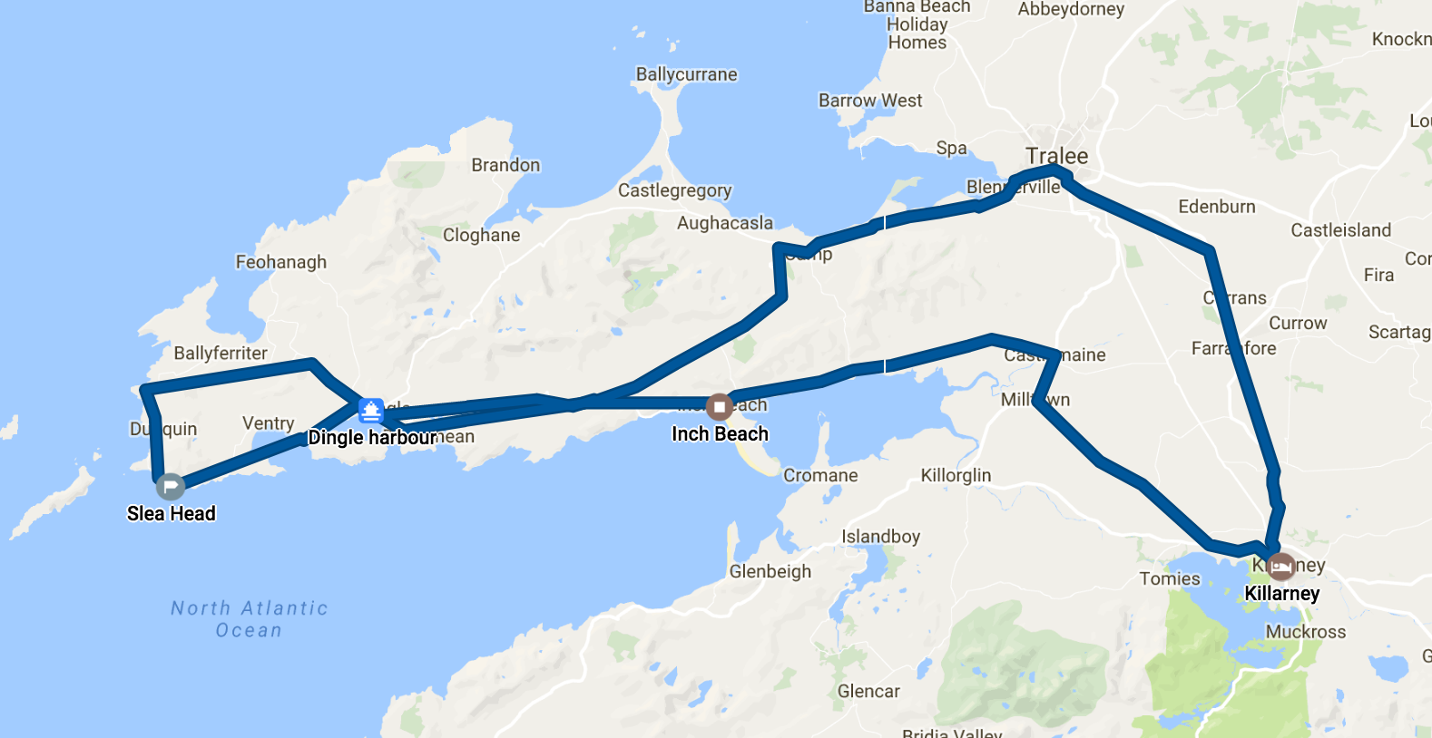
Route that day
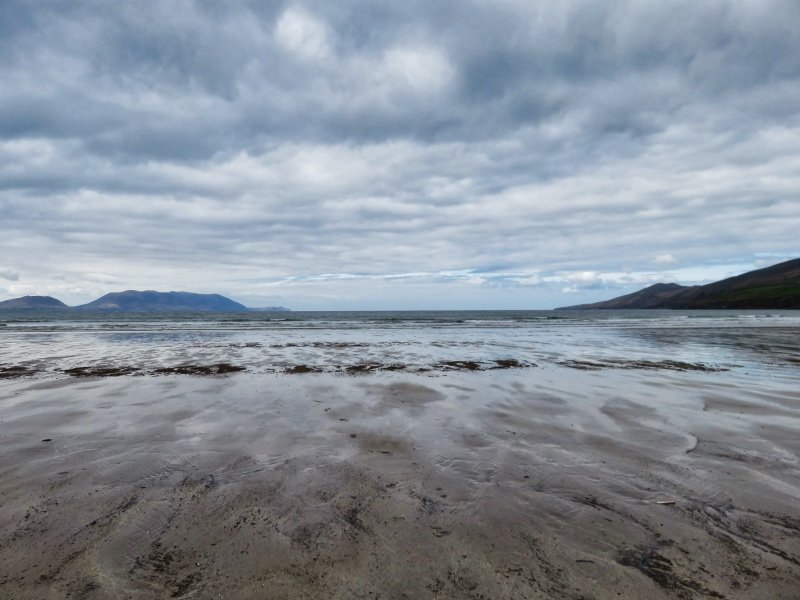
Inch Beach
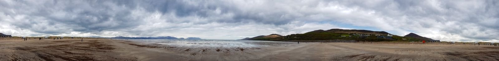
I always like those day tours that let you sleep in a little. Our first stop was Inch Beach and according to the driver a good spot to wake up to. We arrived and it was way too cold. But we were supposed to stop for a pretty long time here. I was done photographing the beach after a few minutes and went to the restaurant to get some brunch to kill time.
I said hello to one of my favourite co-workers... and only then realised how weird it was to find my co-worker on this beach, far away from Dublin where we worked. She was as surprised as me (and also not that much because this totally made sense somehow) and she told me that she had stayed the night on the beach in a campervan.
This was the first beach that I had ever seen where they use the beach as a carpark. This is possible because of the wideness of the beach. It is a shockingly large sandy beach and it will take you a long walk to get to the water.
Parking there isn't completely without risk, though. Every once in a while a car gets flooded by the Atlantic and makes the news. Mostly due to stupidity... But it looked so odd to see a large number of campervans standing on the beach like it was a campsite. And my coworker just woke up and came out of one of these to get herself a coffee.
So suddenly, there wasn't "too much" time on Inch Beach, but it was now too little. We had a quick drink and said goodbye before my bus left.
Taken near Annalack (Repost)
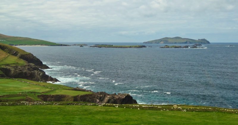
We then left in the direction of Dingle Town and started seeing the typical Irish landscape with stone walls drawing squares in the green fields. We wouldn't stop in Dingle though because the plan was to do that on the way back. But the circular Slea Head Drive starts (and ends) here.
Slea Head
It's definitely in my top 5 of best scenic drives in the world: the Slea Head Drive. It is part of the Wild Atlantic Way, which is a "must-do-before-you-die" kinda thing. Most cars would drive this clockwise so it is easier to stop in the viewing point parking spots and also because going clockwise while driving on the left side of the road makes sure your view won't be blocked by the other tourist buses driving there. However, I also think that bus drivers will kill you for trying to drive counter-clockwise and blocking the sometimes very narrow roads.
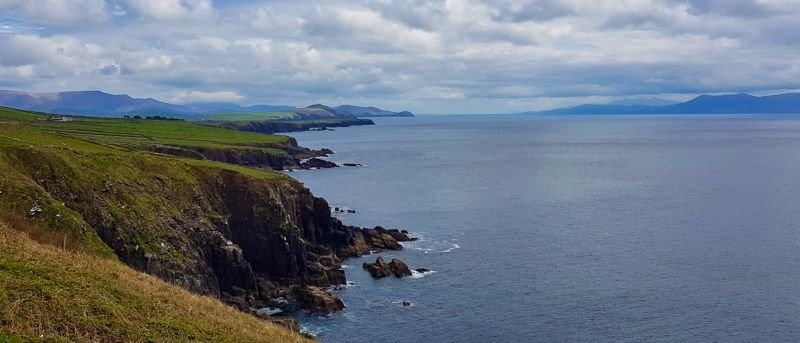
Slea Head cliffs, the main peninsula of Kerry on the right in the distance
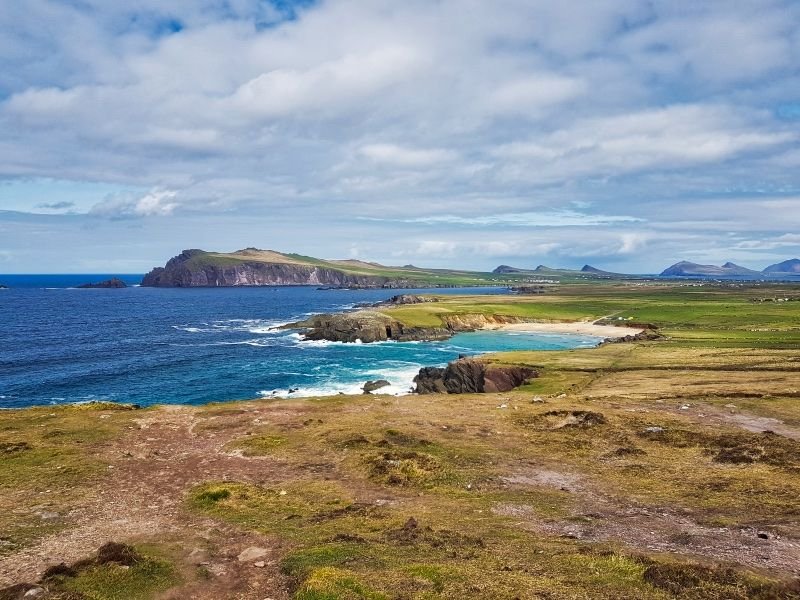
Following the Slea Head Drive, you will reach the most westerly point of Ireland, and if you don't count the Azores, also of Europe: Dunmore Head. Can you imagine staying in a vacation home just close to the edge of those cliffs?
From Slea Head viewing point, looking at Dunmore Head
It keeps surprising me to see so few trees in Ireland. That isn't caused by just recent deforestation (from 1700 on), but can also be blamed on the first farmers of Neolithic time. A large part of Ireland is pretty barren which is pretty difficult to grow trees on. But also the Irish government keeps failing in fixing it (don't be surprised, the Irish government fails a lot).
From the driving bus
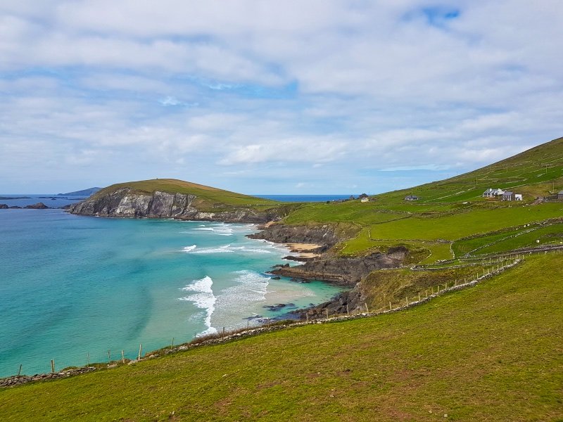
So we keep continuing the Slea Head Drive and see numerous cliffs, farmland, drystone walls, sheep and tiny beaches. The Ferriter's Cove beach near Sybil Point is just gorgeous. In this area, a lot of ancient discoveries were done and this location holds the oldest settlement of the peninsula. We didn't visit the ancient ruins this time, which is a pity since there was plenty of time. But we didn't want to be too late for a good lunch so it was time to get to Dingle!
Sybil Point and Ferriter's Cove
Dingle
After being driven into half-sleep I had a bit of a hard time adjusting. I was back in a town and there were cars and people everywhere! Dingle isn't that large (a population of around 2000 people), but this weekend it was pretty busy with tourists.
You'd say that it makes sense to have a seafood lunch in Dingle, but I went for kebab ;) That way I would have more time to walk around town. From the views from the harbour, it was already clear that this was a colourful town. There were a lot of interesting boutiques in the centre and I found a super fun art gallery where I one day will order a print from!

Colourful houses overlooking Dingle harbour
In the centre of the town, there is a statue of a dolphin named Fungie. This is the local dolphin that has been visiting Dingle since 1983. He has become the town friend since he interacts playfully with people in the water. I didn't see Fungie that day, but I did see the same co-worker from Inch Beach again.
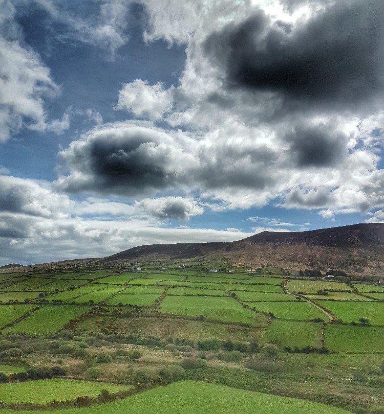
I said goodbye again and it was also time to leave Dingle and return to Killarney. I fell asleep on the way back, but I didn't miss much. We stopped for another final amazing view near Glannagalt before we passed through Tralee and arrived in Killarney.
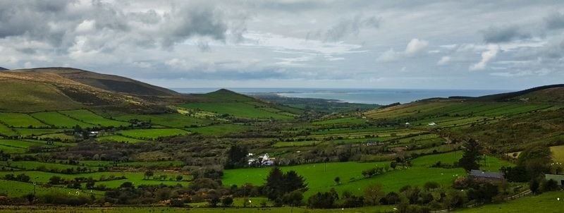
Near Glannagalt
Also in this series:
Ireland & the back arse of nowhere #1: Aran Islands
Ireland & the back arse of nowhere #2: Cliffs of Moher
Ireland & the back arse of nowhere #3: Gap of Dunloe & Lakes of Killarney
Ireland & the back arse of nowhere #4: County Donegal
My California series:
Exploring the Golden State #1: Northern Highway One, Avenue of the Giants, The Lost Coast, Eureka!
Exploring the Golden State #2: Marin County